Severe Weather Statement National Weather Service Shreveport LA 732 PM CDT FRI APR 6 2018
LAC031-081-070100- /O.CON.KSHV.TO.W.0044.000000T0000Z-180407T0100Z/ De Soto LA-Red River LA- 732 PM CDT FRI APR 6 2018
...A TORNADO WARNING REMAINS IN EFFECT UNTIL 800 PM CDT FOR EAST CENTRAL DE SOTO AND CENTRAL RED RIVER PARISHES...
At 732 PM CDT, a confirmed tornado was located 7 miles west of Coushatta, or 13 miles east of Mansfield, moving east at 25 mph.
HAZARD...Damaging tornado and golf ball size hail.
SOURCE...Radar confirmed tornado.
IMPACT...Flying debris will be dangerous to those caught without shelter. Mobile homes will be damaged or destroyed. Damage to roofs, windows, and vehicles will occur. Tree damage is likely.
Locations impacted include... Coushatta, Edgefield, Grand Bayou and Armistead.
PRECAUTIONARY/PREPAREDNESS ACTIONS...
To repeat, a tornado is on the ground. TAKE COVER NOW! Move to a basement or an interior room on the lowest floor of a sturdy building. Avoid windows. If you are outdoors, in a mobile home, or in a vehicle, move to the closest substantial shelter and protect yourself from flying debris.
Last Edit: Apr 6, 2018 18:36:16 GMT -6 by SKYSUMMIT
Buying or Selling Real Estate?--->scottguidry.com Click HERE To Download My FREE MLS Touch App! NWS COOP ID: 16-7425-08 CoCoRaHs ID: LA-TG-23
SKYSUMMIT
Administrator President | Director of Operations
Severe Weather Statement National Weather Service Shreveport LA 739 PM CDT FRI APR 6 2018
LAC031-081-070100- /O.CON.KSHV.TO.W.0044.000000T0000Z-180407T0100Z/ De Soto LA-Red River LA- 739 PM CDT FRI APR 6 2018
...TORNADO EMERGENCY FOR THE CITY OF COUSHATTA...
...A TORNADO WARNING REMAINS IN EFFECT UNTIL 800 PM CDT FOR EAST CENTRAL DE SOTO AND CENTRAL RED RIVER PARISHES...
At 738 PM CDT, a confirmed large and destructive tornado was located near Coushatta, or 16 miles east of Mansfield, moving east at 25 mph.
TORNADO EMERGENCY for Coushatta. This is a PARTICULARLY DANGEROUS SITUATION. TAKE COVER NOW!
HAZARD...Deadly tornado.
SOURCE...Radar confirmed tornado.
IMPACT...You are in a life-threatening situation. Flying debris may be deadly to those caught without shelter. Mobile homes will be destroyed. Considerable damage to homes, businesses, and vehicles is likely and complete destruction is possible.
Locations impacted include... Coushatta, Edgefield, Grand Bayou and Armistead.
PRECAUTIONARY/PREPAREDNESS ACTIONS...
To repeat, a large, extremely dangerous, and potentially deadly tornado is on the ground. To protect your life, TAKE COVER NOW! Move to an interior room on the lowest floor of a sturdy building. Avoid windows. If in a mobile home, a vehicle or outdoors, move to the closest substantial shelter and protect yourself from flying debris.
Tornadoes are extremely difficult to see and confirm at night. Do not wait to see or hear the tornado. TAKE COVER NOW!
A large and extremely dangerous tornado is on the ground. take immediate tornado precautions. this is an emergency situation.
Buying or Selling Real Estate?--->scottguidry.com Click HERE To Download My FREE MLS Touch App! NWS COOP ID: 16-7425-08 CoCoRaHs ID: LA-TG-23
SKYSUMMIT
Administrator President | Director of Operations
I presume based on the warning location that this tornado could have gone right through the heart of town. How does the reflectivity look on radar? Any indication that is the case?
SKYSUMMIT
Administrator President | Director of Operations
I presume based on the warning location that this tornado could have gone right through the heart of town. How does the reflectivity look on radar? Any indication that is the case?
Yes, it was confirmed moving through Coushatta.
At 754 PM CDT, a confirmed large and extremely dangerous tornado was located over Coushatta, or 21 miles east of Mansfield, moving east at 20 mph.
Buying or Selling Real Estate?--->scottguidry.com Click HERE To Download My FREE MLS Touch App! NWS COOP ID: 16-7425-08 CoCoRaHs ID: LA-TG-23
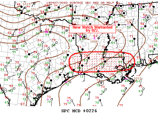
Mesoscale Discussion 0226 NWS Storm Prediction Center Norman OK 0812 PM CDT Fri Apr 06 2018
Areas affected...Southeast TX...Southern LA...Southern MS
Concerning...Severe potential...Watch likely
Valid 070112Z - 070215Z
Probability of Watch Issuance...95 percent
SUMMARY...Severe threat will spread south of ww36 in the next few hours. New watch will likely be issued by 02z.
DISCUSSION...East-west squall line is sagging south of the I-20 corridor and is progressing toward the southern portions of ww36 at roughly 25kt. Over the last hour or so there appears to be a gradual evolution toward less pre-squall line supercells, though this threat can not be ruled out. Latest thinking is a linear MCS will be the predominant convective mode and damaging winds should become the primary severe threat, along with some large hail. While a tornado can not be ruled out, given the observed shear/instability, storm mode is becoming less favorable for discrete structures.
..Darrow/Grams.. 04/07/2018
Buying or Selling Real Estate?--->scottguidry.com Click HERE To Download My FREE MLS Touch App! NWS COOP ID: 16-7425-08 CoCoRaHs ID: LA-TG-23
1 NW Vicksburg [Warren Co, MS] AMATEUR RADIO reports FLASH FLOOD at 6 Apr, 8:15 PM CDT -- NUMEROUS ROADS ARE CLOSED IN VICKSBURG DUE TO FLASH FLOODING.
Buying or Selling Real Estate?--->scottguidry.com Click HERE To Download My FREE MLS Touch App! NWS COOP ID: 16-7425-08 CoCoRaHs ID: LA-TG-23
SKYSUMMIT
Administrator President | Director of Operations
Severe Thunderstorm Watch Number 38 NWS Storm Prediction Center Norman OK 850 PM CDT Fri Apr 6 2018
The NWS Storm Prediction Center has issued a
* Severe Thunderstorm Watch for portions of Central and southern Louisiana Southern Mississippi Southeast Texas Coastal Waters
* Effective this Friday night and Saturday morning from 850 PM until 500 AM CDT.
* Primary threats include... Scattered damaging wind gusts to 70 mph possible Isolated large hail events to 1.5 inches in diameter possible A tornado or two possible
SUMMARY...Extensive west-east oriented line of storms will shift southeast overnight with the primary hazard being damaging winds. A brief tornado or two is possible, primarily across central portions of Louisiana this evening.
The severe thunderstorm watch area is approximately along and 65 statute miles north and south of a line from 20 miles northwest of Port Arthur TX to 45 miles northeast of Gulfport MS. For a complete depiction of the watch see the associated watch outline update (WOUS64 KWNS WOU8).
PRECAUTIONARY/PREPAREDNESS ACTIONS...
REMEMBER...A Severe Thunderstorm Watch means conditions are favorable for severe thunderstorms in and close to the watch area. Persons in these areas should be on the lookout for threatening weather conditions and listen for later statements and possible warnings. Severe thunderstorms can and occasionally do produce tornadoes.
Buying or Selling Real Estate?--->scottguidry.com Click HERE To Download My FREE MLS Touch App! NWS COOP ID: 16-7425-08 CoCoRaHs ID: LA-TG-23
SKYSUMMIT
Administrator President | Director of Operations
Tornado Warning National Weather Service Shreveport LA 917 PM CDT FRI APR 6 2018
The National Weather Service in Shreveport has issued a
* Tornado Warning for... West central Grant Parish in north central Louisiana... Southeastern Natchitoches Parish in northwestern Louisiana...
* Until 1000 PM CDT
* At 917 PM CDT, a severe thunderstorm capable of producing a tornado was located near Montgomery, or 13 miles southeast of Natchitoches, moving southeast at 25 mph.
HAZARD...Tornado and quarter size hail.
SOURCE...Radar indicated rotation.
IMPACT...Flying debris will be dangerous to those caught without shelter. Mobile homes will be damaged or destroyed. Damage to roofs, windows, and vehicles will occur. Tree damage is likely.
* This dangerous storm will be near... Colfax around 955 PM CDT.
Other locations impacted by this tornadic thunderstorm include Chopin, Cloutierville, Melrose and Aloha.
PRECAUTIONARY/PREPAREDNESS ACTIONS...
TAKE COVER NOW! Move to a basement or an interior room on the lowest floor of a sturdy building. Avoid windows. If you are outdoors, in a mobile home, or in a vehicle, move to the closest substantial shelter and protect yourself from flying debris.
&&
Buying or Selling Real Estate?--->scottguidry.com Click HERE To Download My FREE MLS Touch App! NWS COOP ID: 16-7425-08 CoCoRaHs ID: LA-TG-23
SKYSUMMIT
Administrator President | Director of Operations
Tornado Warning National Weather Service Jackson MS 919 PM CDT FRI APR 6 2018
The National Weather Service in Jackson has issued a
* Tornado Warning for... Southeastern Claiborne County in southwestern Mississippi... Southwestern Copiah County in central Mississippi...
* Until 1000 PM CDT
* At 919 PM CDT, a severe thunderstorm capable of producing a tornado was located near Pattison, or 28 miles south of Vicksburg, moving east at 40 mph.
HAZARD...Tornado.
SOURCE...Radar indicated rotation.
IMPACT...Flying debris will be dangerous to those caught without shelter. Mobile homes will be damaged or destroyed. Damage to roofs, windows, and vehicles will occur. Tree damage is likely.
* This dangerous storm will be near... Hermanville around 925 PM CDT. Peyton around 935 PM CDT. Barlow around 945 PM CDT.
PRECAUTIONARY/PREPAREDNESS ACTIONS...
TAKE COVER NOW! Move to a basement or an interior room on the lowest floor of a sturdy building. Avoid windows. If you are outdoors, in a mobile home, or in a vehicle, move to the closest substantial shelter and protect yourself from flying debris.
Buying or Selling Real Estate?--->scottguidry.com Click HERE To Download My FREE MLS Touch App! NWS COOP ID: 16-7425-08 CoCoRaHs ID: LA-TG-23
Shoutbox
ozell: Ernesto gonna mog hard. I'm voting Alberto, Ernesto, Rafael and Deshawn
Apr 1, 2024 19:15:21 GMT -6
SKYSUMMIT: Farmasi gal (slprejean) Yes...just click the link and then send a PM to either TIgergirl or myself. I can then shoot her a text letting her know and I'll add your supporter tag. THANK YOU!!!!
Sept 23, 2023 16:08:37 GMT -6
Farmasi gal (slprejean): At the risk of this being a dumb question. In order to donate, do I follow the instructions when I click “donate”, and then message tigergirl? I see people comment here that they donated, so I wasn’t sure if that had changed.
Sept 20, 2023 10:54:40 GMT -6
SKYSUMMIT: Great to have you back!
Sept 11, 2023 12:20:30 GMT -6
virginialee: Hi Skysummit: I was part of this back at the beginning. So happy to be back.
Sept 8, 2023 5:08:12 GMT -6
SKYSUMMIT: Thanks to everyone who has recently donated! If I missed anyone and you still need a Supporter Tag, let me know.
Sept 7, 2023 13:20:10 GMT -6
akeller11: Just donated
Sept 6, 2023 11:11:36 GMT -6
SKYSUMMIT: Thanks guys and gals! You're very much appreciated!
Aug 30, 2023 11:48:38 GMT -6
nolachic: Well peeps, it's this time of year. Good to see everyone back. Hopefully, this season allows us to go way off topic and just shoot the shit instead of crapping our pants! Cheers to all! E
Aug 27, 2023 13:19:41 GMT -6
dwill31: Just donated $100 and the message to to Im you
Aug 25, 2023 16:58:49 GMT -6
grisairgasm: Hope u are doing well. Saw u at the clinic a few weeks back and wanted to say high but looked like u were with a patient. G
Aug 22, 2023 17:53:18 GMT -6
SKYSUMMIT: schexstorm I just replied to your post. I believe it's a glitch b/c you're not the first person I hear this from. You're not banned.
Jun 27, 2023 5:29:04 GMT -6
schexstorm: opened up the site on my phone this am and it said I was banned from the forum? I never posted or anything. Do you know what could be the problem? thanks
Jun 24, 2023 6:38:13 GMT -6
SKYSUMMIT: I keep forgetting we have a chat box down here lol
May 4, 2023 15:48:01 GMT -6
saintlybraves: where is this so called "low" supposed to develop? Any better indications with modeling today? We are going to Destin this week and of course I'd like for a more westerly setup.
Apr 10, 2023 16:04:49 GMT -6
mysterionz: hello I’m new here
Apr 3, 2023 15:56:46 GMT -6
frankp: Hey neighbor can u please send me the local Alabama weather forum that you follow, much appreciated… frank
Jan 21, 2023 13:57:45 GMT -6
frankp: Hey neighbor, can u send the the link of the Alabama weather forum you visit, much appreciated
Jan 21, 2023 13:55:49 GMT -6