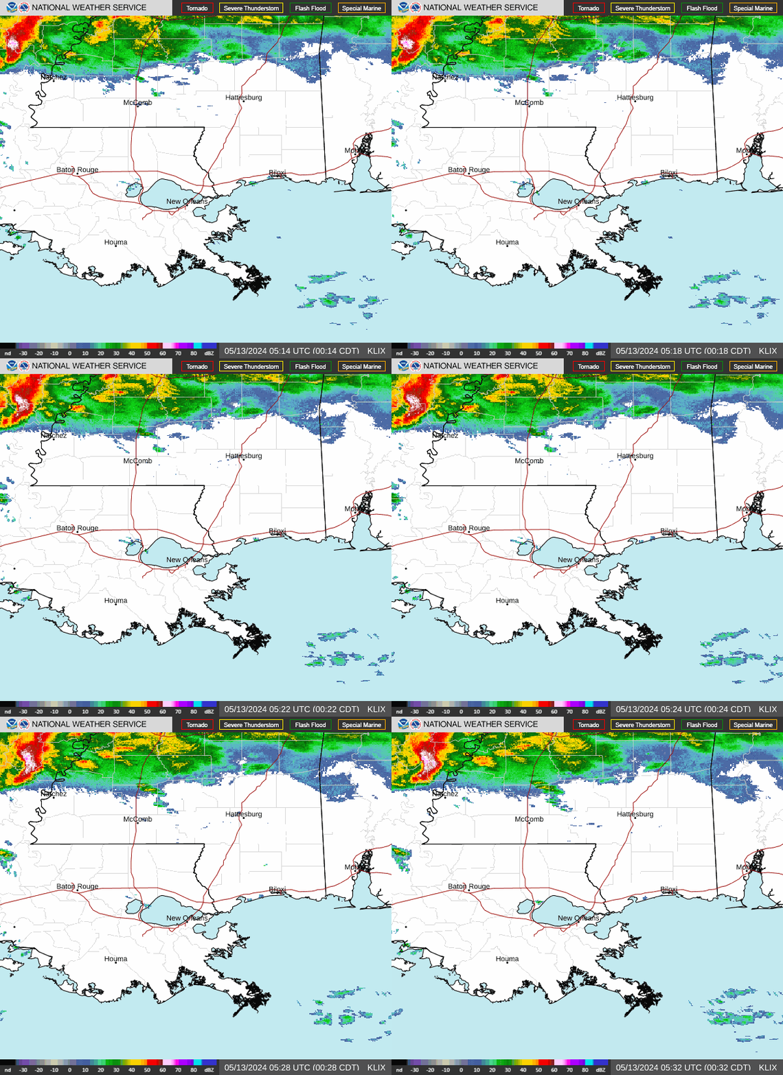
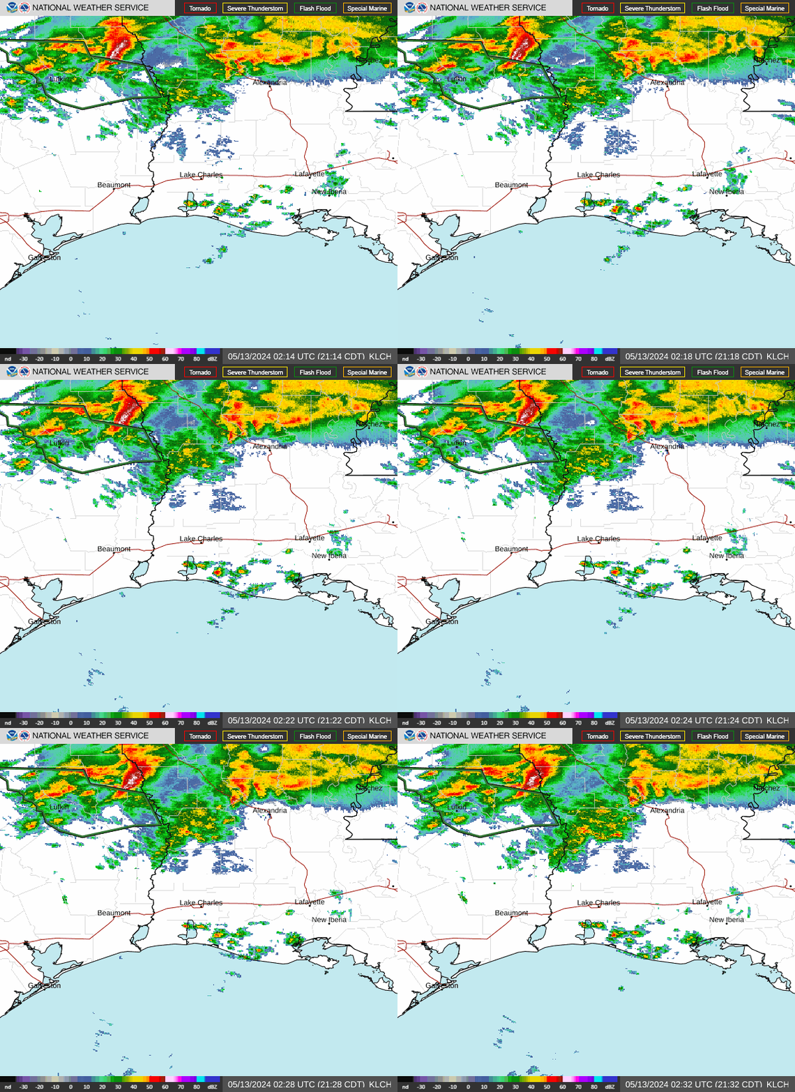
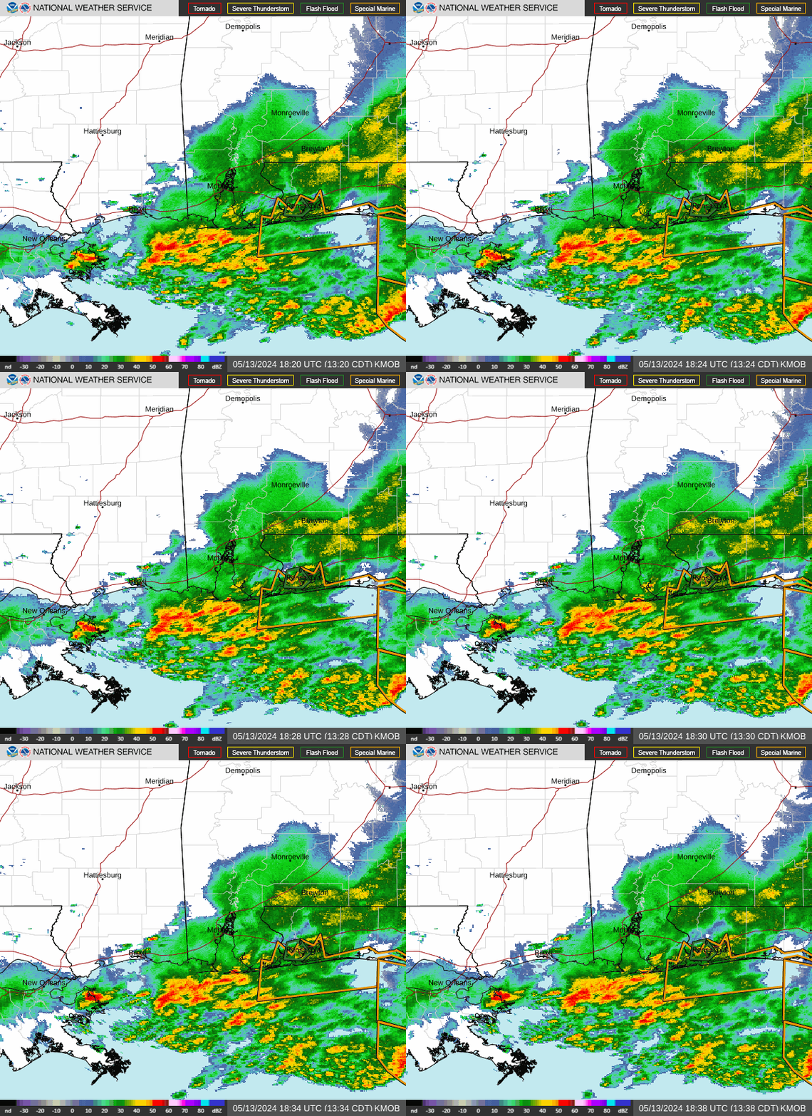
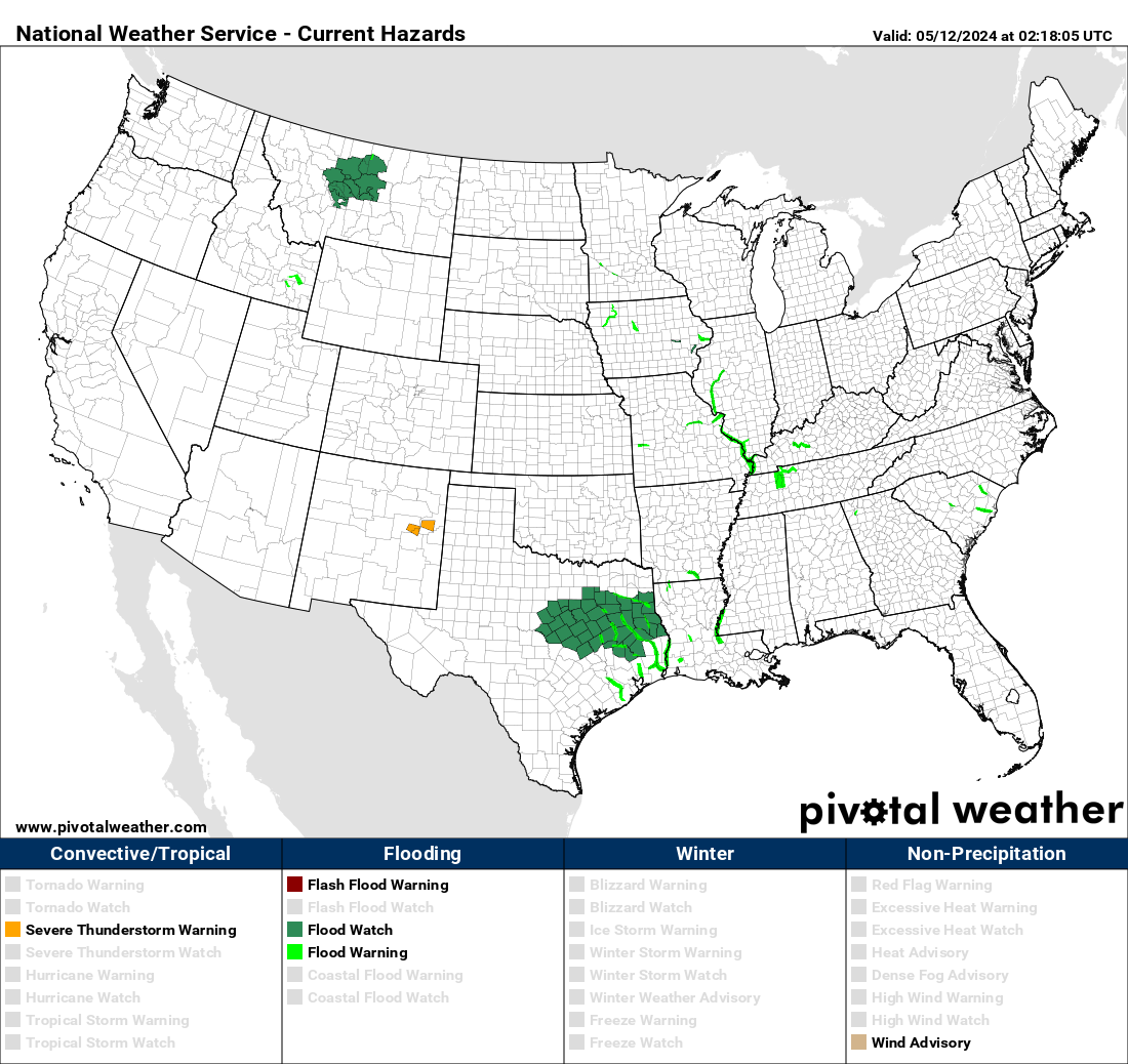
SUMMARY...Trailing edge of convection filling in with potential for increased rainfall totals due to training through evening.
DISCUSSION...GOES-E Visible and regional RADAR mosaic denote continued convective development and expansion from far SE TX and north of I-10 in LA. This is response to destabilization but also increased orthogonal convergence with increased surface flow from the sea-breeze as the shortwave exits and the surface pressure trof trails more flat with further distance from the trailing cold front. Flow off the Gulf is a tad more moist/unstable with sfc Tds in the low to mid-70s and MLCAPEs of 2000-3000 J/kg stretching across S LA/S MS along/ahead of the boundary. While the broad southerly flow 85H will slowly veer it will continue to provide strong moisture flux convergence to maintain/expand the convection further, while flow aloft will generally steer cells along in an easterly fashion resulting in training convection. CIRA LPW denotes very moist airmass pooled along the axis with 1" in the sfc-850, but still and additional .75" in the 850-7H layer suggesting further broadening of the updrafts with broad entrainment to keep rainfall efficiency on average at 2"/hr with likely some stronger cells perhaps yielding localized 3"/hr rates. As a result, 3-5" totals are likely with greatest values further east into NE LA/S MS due to duration of the training, perhaps even result in a spot or two of localized 6" totals.
While FFG values are in more typical ranges for the season, of 3"/hr & 4"/3hr along/south of I-10; AHPS 2-week anomalies supported by 0-40 cm soil saturation of 70-80% along the northern half of MPD area of concern suggests a slight greater concern across this area versus areas from Lake Charles to Baton Rouge where ground conditions may be a bit drier and less prone to flash flooding from these expected rainfall totals. As such, flash flooding is considered possible further west where drier ground conditions exist...through by late evening becoming more likely further north and east into S MS by 00z.
Gallina
Hammond, LA NWS COOP ID: 16-7425-08 CoCoRaHs ID: LA-TG-23
SKYSUMMIT President | Director of OperationsAdministrator
Radar is picking up over 90mph in velocities with that Jackson storm! Radar beam is only around 600' off the ground there as well. No doubt damaging winds are occurring at the surface.
Hammond, LA NWS COOP ID: 16-7425-08 CoCoRaHs ID: LA-TG-23
Post by Shibumi-Mandeville I-12/Hwy59 on May 4, 2021 13:50:59 GMT -6
I'm always impressed how the NWS gets the placement of these events so well.....let's see if we get any stragglers further south......wont take much for anything semi-organized to go severe
Post by philstorm91 - Greenwell Spring on May 4, 2021 13:52:10 GMT -6
With the line of storms obviously sidling southwards, I wonder how long it will take for LIX to issue some kind of severe thunderstorm or tornado watch for parishes further south than currently?
Post by grisairgasm on May 4, 2021 13:52:11 GMT -6
My pad won’t play the live video.Damn. Please post another image if u see something interesting. People are having trouble driving I55 right now. Many slow or pulled over cars.
I'm always impressed how the NWS gets the placement of these events so well.....let's see if we get any stragglers further south......wont take much for anything semi-organized to go severe
Agree.
SKYSUMMIT President | Director of OperationsAdministrator
Post by grisairgasm on May 4, 2021 13:56:32 GMT -6
My gut says will be significant widespread damage in Mississippi and probably elsewhere. Tornado should pass just N of Brandon. Looks to be embedded on the leading edge. Scary. Regardless, that area has really grown and this may not be pretty.
SKYSUMMIT President | Director of OperationsAdministrator
Severe Thunderstorm Warning National Weather Service New Orleans LA 258 PM CDT Tue May 4 2021
The National Weather Service in New Orleans has issued a
* Severe Thunderstorm Warning for... Northeastern West Feliciana Parish in southeastern Louisiana... Northeastern Pointe Coupee Parish in southeastern Louisiana... East Feliciana Parish in southeastern Louisiana... Eastern Wilkinson County in southern Mississippi... Amite County in southern Mississippi...
* Until 345 PM CDT.
* At 257 PM CDT, severe thunderstorms were located along a line extending from near Garden City to near St. Francisville, moving east at 45 mph.
HAZARD...60 mph wind gusts and quarter size hail.
SOURCE...Radar indicated.
IMPACT...Hail damage to vehicles is expected. Expect wind damage to roofs, siding, and trees.
My gut says will be significant widespread damage in Mississippi and probably elsewhere. Tornado should pass just N of Brandon. Looks to be embedded on the leading edge. Scary. Regardless, that area has really grown and this may not be pretty.
I have firsthand info that that sucked. It passed down Lakeland Drive...about 100 yards north of me.
Post by grisairgasm on May 4, 2021 14:11:04 GMT -6
The line extends from Houston to Tupelo. Radar is just growling away. Things are beginning to look nasty on the Northshore back towards Baton Rouge. Like I said before, I don’t ever trust spring storms.
My gut says will be significant widespread damage in Mississippi and probably elsewhere. Tornado should pass just N of Brandon. Looks to be embedded on the leading edge. Scary. Regardless, that area has really grown and this may not be pretty.
I have firsthand info that that sucked. It passed down Lakeland Drive...about 100 yards north of me.
Man.....what kind of winds do u think? Unbelievable. That area continues to be some type of freaky weather magnet.