Post by Deleted on Jun 11, 2014 4:26:42 GMT -6
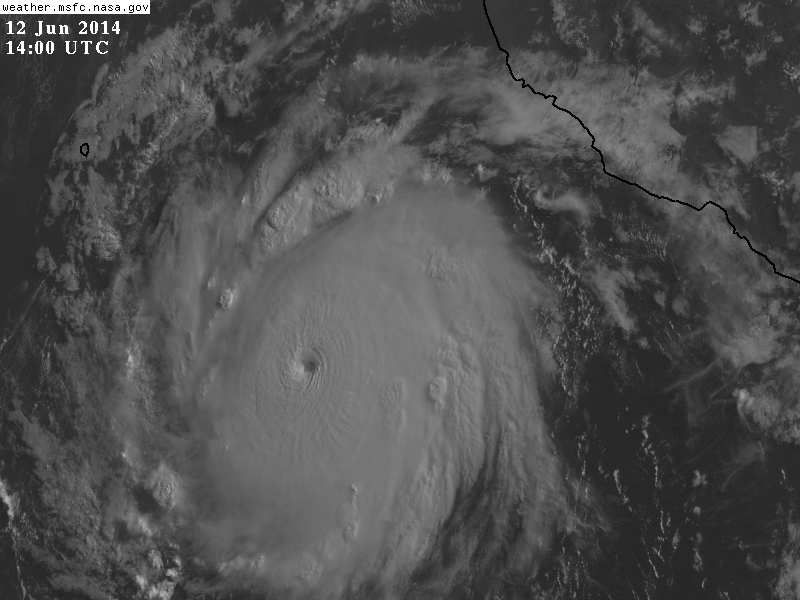
Cristina is a hurricane.
HURRICANE CRISTINA DISCUSSION NUMBER 7
NWS NATIONAL HURRICANE CENTER MIAMI FL EP032014
200 AM PDT WED JUN 11 2014
Cristina continues to intensify. The cyclone consists of a small
central dense overcast in geostationary satellite imagery with
cold-topped convection to -80C in the northern semicircle. There
have been faint hints of eye or warm spot during the past several
hours, and a 0329 UTC TRMM overpass showed a closed low- to mid-
level ring of convection surrounding the center. Satellite
classifications from TAFB and SAB supported an intensity of 60 kt at
synoptic time. However, the initial intensity estimate is increased
to 65 kt, based on UW-CIMSS ADT values now to 4.5/77 kt and the
persistence of an eye feature that has warmed slightly and become
better defined.
The cyclone has been moving south of due west in response to a
strong mid-level ridge over northwestern Mexico, but the heading
appears to have recently become more westerly. The ridge is
forecast to either remain in place or shift slightly eastward during
the next few days, which should cause the track of Cristina to
gradually bend west-northwestward. The track guidance is in
generally good agreement on this scenario, but small differences
in the location of the ridge over Mexico lead to slightly different
motion headings. The ECMWF maintains the center of the ridge a bit
to the west of the GFS and other models, resulting in a solution on
the southern side of the guidance envelope. The NHC track forecast
is adjusted a hair to the left of the previous one in the direction
of the ECMWF, which has continued to correctly forecast a more
southern track.
The environment in which Cristina is embedded remains ideal for
intensification. The cyclone is located underneath a mid- to upper-
level ridge axis and over very warm waters. The inner core
structure has also become better defined, with the closed ring
seen in microwave imagery signaling that rapid intensification is
a possibility. The NHC forecast is adjusted upward in the short
term based on current trends, and thee is some potential for
Cristina to become stronger than forecast. In about 60 hours,
Cristina should encounter increasing southwesterly shear associated
with an upper-level trough extending southwestward from California
coast and should reach markedly cooler waters in about 4 days. This
should result in a pronounced weakening trend at the end of the
forecast period and perhaps a quick demise. The NHC intensity
forecast is close to the multi-model consensus through 72 hours and
near the LGEM after that time.
FORECAST POSITIONS AND MAX WINDS
INIT 11/0900Z 15.2N 104.1W 65 KT 75 MPH
12H 11/1800Z 15.3N 105.2W 75 KT 85 MPH
24H 12/0600Z 15.7N 106.6W 80 KT 90 MPH
36H 12/1800Z 16.4N 108.0W 85 KT 100 MPH
48H 13/0600Z 17.2N 109.4W 85 KT 100 MPH
72H 14/0600Z 18.6N 111.8W 70 KT 80 MPH
96H 15/0600Z 19.2N 113.5W 55 KT 65 MPH
120H 16/0600Z 19.6N 114.7W 35 KT 40 MPH
$$
Forecaster Kimberlain


