Post by Briella - Houma on Apr 2, 2017 3:47:43 GMT -6
AREA FORECAST DISCUSSION
National Weather Service New Orleans LA
429 AM CDT Sun Apr 2 2017
.DISCUSSION...
The potential for a widespread heavy rain event tonight is looking
more and more likely. WPC has issued a slight to moderate risk for
excessive rainfall over much of the forecast area. In addition to
heavy rainfall, severe thunderstorms will be possible as well with a
slight to moderate risk.
An upper low is currently moving east across northern Mexico into
West Texas will track east into Central Texas today before moving
northeast to the southern plains tonight. This will put the local
area between the jet wrapping around the upper low and subtropical
jet. Low level convergence and upper divergence will be very strong
in the general region of difluence across Louisiana and Mississippi.
Gulf moisture will surge northward into the area ahead of the
approaching system this evening and overnight. Surface dewpoints are
expected to reach into the lower 70s. Looking at GFS and NAM model
soundings, atmospheric moisture levels will be EXTREMELY HIGH with
peak precip water values ranging from 1.8-2" as convection moves
across the CWA. For reference, the 90th percentile for this time of
year is less than 1.5". So hitting the 2" mark is well into record
territory. Seeing numbers like that definitely increases the concern
for a heavy rainfall event. The ECMWF has been the most consistent
model from run to run, suggesting the heaviest rain to be over
southern and southeast LA vs the GFS`s solution of central MS. Areal
coverage of 3-6" will be possible with isolated amounts possibly
reaching upwards of 8-10". Those amounts are roughly over about a 12-
18 hour period from this afternoon through Monday morning.
Convection may start nudging into western zones this afternoon
before 00z, so have increased pops to 60% there. A flash flood watch
remains in effect with no changes made to that product.
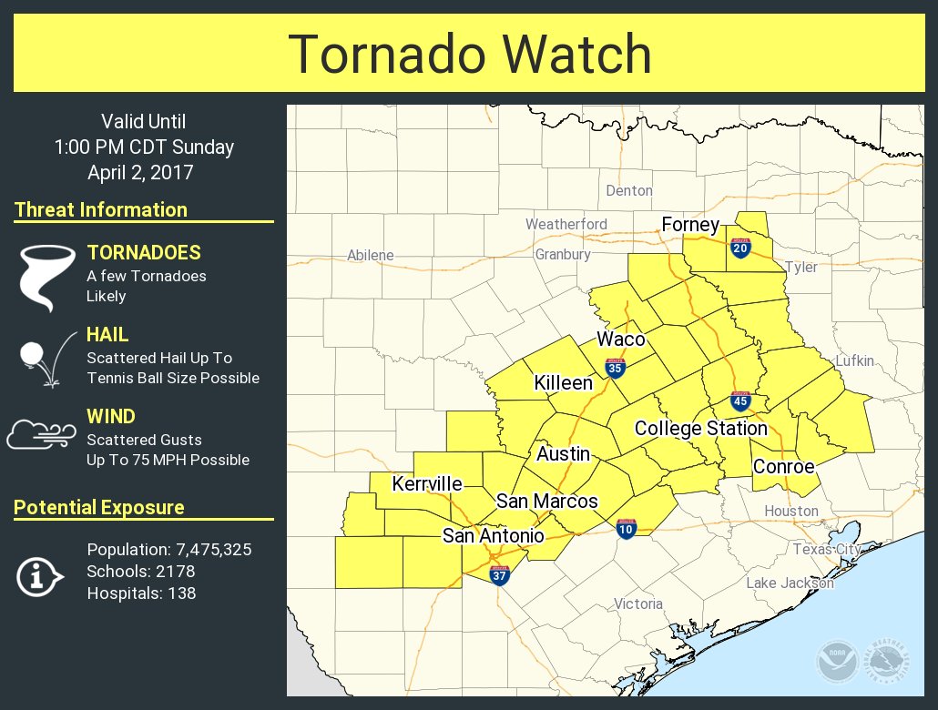
As noted earlier, there is a slight to moderate risk for severe
weather tonight. Before the column becomes completely saturated, mid
level dry air will still be in place. Mid level cooling and
increasing surface moisture will steepen mid level lapse rates and
decrease LI`s. The close proximity of the upper low to the CWA will
result in quite strong winds throughout the boundary layer and thus
increase shear values to 30-50 knots. SRH at the same time should be
over 200 m2/s2. Those parameters suggest increased threat for
damaging winds and a few tornadoes. The window of opportunity for
surface based convection will be relatively short if model soundings
are correct in showing a warm nose developing around 03Z. This trend
will progress east with time. A general lowering of severe threat
will take place in eastern zones as well. The best chance for
strongest storms at this times appears to be NW of a Donaldsonville
to Franklinton line.
There will even more weather impacts to the CWA besides possible
flash flooding and severe weather. The pressure gradient over the
region will be tightening as a sub-1000mb sfc low develops and moves
across northeast TX and eastern OK tonight. This enhance low level
flow and elevate southeasterly winds significantly. MAV guidance
indicated sustained winds near 25 mph reaching as far north as I-12.
Therefore, will be issuing a wind advisory for coastal MS and much
of SELA. Additionally, increasing astronomical tides in combination
with strong onshore flow will likely result in minor coastal
flooding. Thinking that tides will be 1-2 feet above normal. Thus,
will be issuing a coastal flood advisory for SE facing shores of the
CWA.
The heavier rain threat should be rapidly moving east Monday as the
upper trough races ENE. Will likely have sunny skies by the
afternoon, especially for western portions of the CWA.
A return to warmer temperatures and no rainfall is expected Monday
through Tuesday. Models show a much deeper long wave trough tracking
across the country through the middle of the week. This will bring
the threat of rainfall back to the region Wednesday. Much colder air
will filter into the forecast area Thursday and Friday behind a cold
front associated with that system. Expect a 15 to 20 degree drop in
temps Thurs with a gradual moderation thereafter.


