Post by SKYSUMMIT on Apr 1, 2018 10:32:12 GMT -6

Day 3 Convective Outlook
NWS Storm Prediction Center Norman OK
0229 AM CDT Sun Apr 01 2018
Valid 031200Z - 041200Z
...THERE IS A SLIGHT RISK OF SEVERE THUNDERSTORMS ACROSS PARTS OF
THE SOUTHERN PLAINS AND LOWER MISSISSIPPI VALLEY NORTHEASTWARD INTO
THE MID MISSISSIPPI VALLEY...
...THERE IS A MARGINAL RISK OF SEVERE THUNDERSTORMS ACROSS PARTS OF
THE SOUTHERN PLAINS AND LOWER MISSISSIPPI VALLEY EXTENDING
NORTHEASTWARD INTO THE OHIO VALLEY...
...SUMMARY...
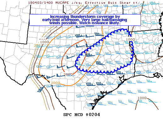
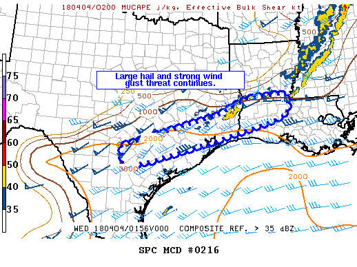
Thunderstorms associated with wind damage and large hail will be
possible on Tuesday across parts of east-central Texas and Louisiana
into southern Arkansas. Marginally severe storms will be possible on
Tuesday from the lower to mid Mississippi Valley into the Ohio
Valley.
...East-central Texas/Lower to Mid Mississippi Valley...
An upper-level trough is forecast to move across the Great Plains on
Tuesday as a belt of strong mid-level flow translates eastward
through the base of the trough. At the surface, a cold front is
forecast to move southeastward across the south-central U.S. and
should be located from east-central Texas northeastward into the
central Arkansas by mid afternoon. Model forecasts suggest that
surface dewpoints will be in the 60s F ahead of the front where
moderate instability may develop during the day. Thunderstorms are
expected to initiate along the front and move eastward across the
slight-risk area from the mid afternoon to the early evening. GFS
forecast soundings for Shreveport at 00Z/Wednesday show MLCAPE
values around 1000 J/kg with steep low-level lapse rates and 0-6 km
shear near 45 kt. This would be enough to support supercells and/or
organized line segments. Model forecasts seem to suggest that the
favored mode will be linear although uncertainty remains substantial
at this time. Deep-layer shear is forecast to gradually drop off
with southwestward extent but stronger instability will probably
compensate for the lessening shear. For this reason, a severe threat
will be possible across east-central Texas as well. Large hail and
damaging winds are expected to be the primary threats.
...Mid Mississippi Valley/Ohio Valley...
An upper-level trough is forecast to move across the central and
northern Plains on Tuesday as a cold front advances quickly
east-southeastward into the Ohio and mid Mississippi Valleys.
Thunderstorms are forecast to develop along the front around mid
afternoon with this convection moving eastward into the Ohio Valley
and western Tennessee Valley during the late afternoon and early
evening. GFS forecast soundings near Paducah show 0-6 km shear near
45 kt with steep mid-level lapse rates. The stronger instability
should remain over the mid Mississippi Valley where MLCAPE could
reach 1000 J/kg if cloud cover remains minimal. This combined with
the shear and strong large-scale ascent would support a potential
for squall-line development and some wind damage. Instability is
forecast to drop off with northeastward into the Ohio Valley where
more uncertainty exists concerning a severe threat. An upgrade to
slight risk would be possible in later outlooks if model updates
suggest that more instability will develop than is currently
forecast.
..Broyles.. 04/01/2018


