Post by grisairgasm on Mar 3, 2020 19:39:37 GMT -6
I had almost completely forgot that April weather event back then. It ranks as one of the strangest weather I have ever seen. After the storms past the wind blew for a few hours probably up to 40mph at times. It wasn’t a front and all convective activity had moved east. In the simplest of terms it left some kind of baroclinic “hole” that was being filled. It was bizarre.
SKYSUMMIT
Administrator President | Director of Operations
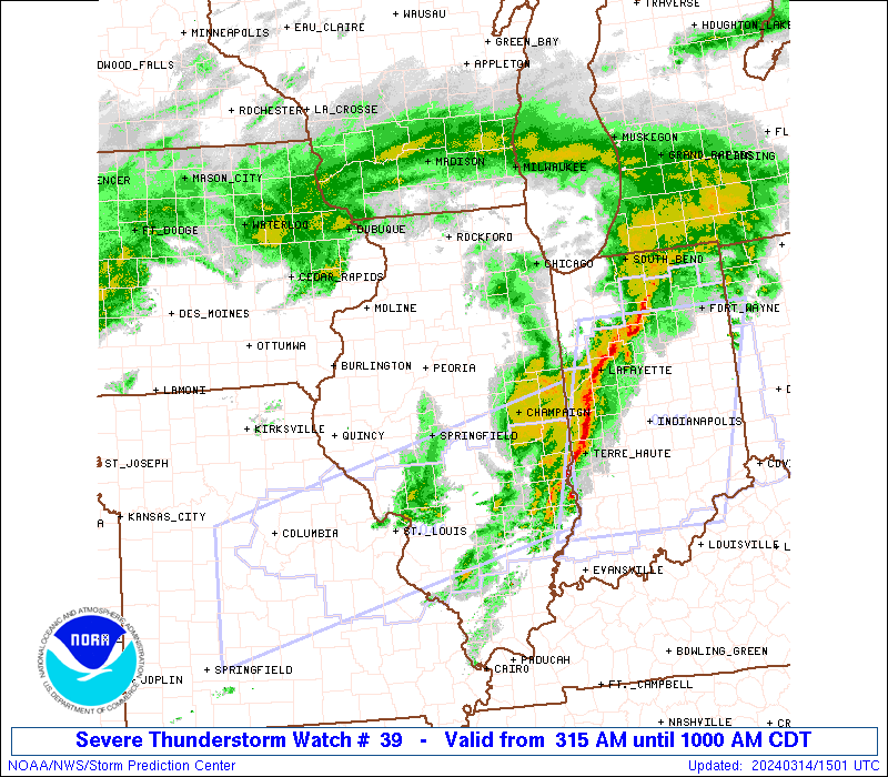
Tornado Watch Number 39 NWS Storm Prediction Center Norman OK 150 AM CST Wed Mar 4 2020
The NWS Storm Prediction Center has issued a
* Tornado Watch for portions of Southwestern Alabama The western Florida Panhandle Parts of northeastern and southeastern Louisiana Much of central and southern Mississippi
* Effective this Wednesday morning from 150 AM until 1000 AM CST.
* Primary threats include... A couple tornadoes possible Scattered large hail likely with isolated very large hail events to 2 inches in diameter possible Scattered damaging wind gusts to 70 mph likely
SUMMARY...Thunderstorms are expected to increase in coverage and intensity through the morning hours from Louisiana into Mississippi and southwestern Alabama, along and north of a stalled front. The storms will be more elevated with northward extent, posing mainly a large hail and damaging wind threat. Closer to the front, storms will be rooted near the ground, where a couple of tornadoes will be possible.
The tornado watch area is approximately along and 60 statute miles north and south of a line from 25 miles west northwest of Natchez MS to 25 miles north northeast of Crestview FL. For a complete depiction of the watch see the associated watch outline update (WOUS64 KWNS WOU9).
PRECAUTIONARY/PREPAREDNESS ACTIONS...
REMEMBER...A Tornado Watch means conditions are favorable for tornadoes and severe thunderstorms in and close to the watch area. Persons in these areas should be on the lookout for threatening weather conditions and listen for later statements and possible warnings.
&&
AVIATION...Tornadoes and a few severe thunderstorms with hail surface and aloft to 2 inches. Extreme turbulence and surface wind gusts to 60 knots. A few cumulonimbi with maximum tops to 500. Mean storm motion vector 28040.
Buying or Selling Real Estate?--->scottguidry.com Click HERE To Download My FREE MLS Touch App! NWS COOP ID: 16-7425-08 CoCoRaHs ID: LA-TG-23
Post by Will - Ascension Parish on Mar 4, 2020 9:13:53 GMT -6
My dew point is 71.
What’s the thinking this morning regarding the area this sets up? Still thinking just north of Baton Rouge or is that different now? Because all the action is in north Louisiana right now. Is to supposed to move into the area later?
Post by thermalwind - Touro on Mar 4, 2020 9:19:22 GMT -6
On any severe weather day, it's a good idea to get an idea of what's actually in place to start with.
Surface:
I assume this image will update all day but this write up is for 12z. So obvious front is obvious looking at the surface obs. Wind out of the south below it, north (and weak) above. Low in central Texas will want to ride that boundary, as it gets it's power from feeding on temperature gradients. You can see this to be true with that second 1000 mb low sitting along the boundary near Atmore, AL.
We need to watch how the front progresses today. Now where's the rain?
So comparing to the surface analysis we have an little squall riding the cold front on the south side of the low pressure system. Then the bulk of the rain would appear to be riding the isentropic lift train with warm gulf air riding over the front. South of the front, the marine layer is keeping a lid on it with no forcing mechanism close by. You can see how that might change later with both some sunlight getting through and warming the surface and the rain near Mobile thanks to a little help from that lead surface low nearby.
The elevated showers near and north of the cold front have shown severe potential this morning, with some mesocyclones near our Texas low pressure and McDonald's sauce packet sized hail in Mississippi.
So now, let's take a look at the upper air plots from the SPC.
Upper low centered near big bend. Surface low in it's traditional position to the east of the upper low, feeding on that increasing vorticity advection. This upper low will progress east as the day goes along, moving the lifty dynamics along with it.
Got us an upper jet streak rolling from Mexico to southern Texas and into north Louisiana, Mississippi, and Alabama. Look at all the upper divergence where all the rain is currently falling. Also, I'd call that the right entrance region, wouldn't you? Not a clean strong jet streak, but it's there.
At 850 mb, you can see how the rain is lining up roughly with where the dew point gradient gets tight. You know, it's all getting squeezed out up there.
Who wants more!? I'm sure the answer is nobody, but I'm doing it anyway. Deal with it. It's sounding time.
Shreveport:
Obvious frontal passage is obvious. Plenty of shear from the surface up to 700 mb, with all of it situated about 850-700 mb. Plenty enough for elevated rotations with some storms. Lapse rates over 6.5 C/km from 700 up above 500 mb and that's where the instability is. So hail potential is there.
Slidell:
That's freakin' juicy. Kind of surprised at what's available already to be honest.
Inversion at 850 mb noted to keep the cap on for a while. SRH from surface to 1 km a healthy 170 and even greater as we get up to about 700 mb. Absolutely could see surface based convection pop off with that temperature profile and there's plenty of spin to work with. The other thing that jumps out is the lapse rates. 7.4 C/km in the 700-500 range, and maxing out at 8.8 as it pushes up into the freezing level. So definitely need to watch for hail today because the uppers will cool some more as the upper low approaches the region. Some of it could be pretty big for this part of the world. Also enough a dry gap above 850 mb to bring down some stronger winds.
Atmosphere has a lot of potential, but how our cap breaks (if it does) and convective interference can and probably will limit how many storms will fully take advantage of what's here. This is the story for the warm sector.
That's the right now. Next post, I'll look at the CAMs and how the front is projected to move as the day goes along and get the LIX discussion involved as well.
SKYSUMMIT
Administrator President | Director of Operations
Post by thermalwind - Touro on Mar 4, 2020 9:34:24 GMT -6
By mid morning, the boundary in MS will slide south, effectively
shunting surface based potential in SW MS. After a late morning
lull, models show a surface low will be tracking east along the
Louisiana coastline. The appendant warm front will provide the
focus for another round of severe potential. This time, it looks
like the main region will be south of I-12, from Houma to New
Orleans. Baton Rouge may have a hour or 2 window of opportunity,
but thats it as the front moves through them quickly and a strong
inversion develops. Model sounding at MSY shows quite high
uninhibited CAPE (2400j/kg) and LI`s up to -8. Low level shear and
SRH are on the low side at 100m2/s2 for SRH and 20-30kts of
shear. Low shear/high CAPE environments are notoriously over
achievers for the local CWA. Thinking big hail, by New Orleans
standards, and a few tornadoes are possible in this warm sector.
Not sure if shear can support a strong tornado, but at least
thinking along those lines as a possibility. 21Z to 06Z is looking
like the general window of greatest threat.
Cold pool from the rain would appear to drive the frontal boundary south through the morning. That boundary will be the focus for the northshore. Lots of shear, not a lot of surface based potential for the I-12 crowd. Looking at the sounding for this morning though, it's obvious why the warm sector concern is there for us southshore and cajun people down by the coast.
To note the difference, let's pull up the NAM soundings for noon today from the 12z run.
New Orleans. That inversion hangs around on all the CAMs and they don't produce much in the way of storms in the danger area but damn if that isn't pretty loaded for trouble.
Northshore. Boundary pushes through, totally cutting off surface based storms. A lot of twist to work with and stronger mid level winds there too. There is severe potential there but those storms will almost certainly be elevated. Don't discount that boundary though for a focus for some short lived severe storms today.
So keep watching the surface analysis for front position and keep an ear out for warnings, especially south of I-10 this afternoon.
What’s the thinking this morning regarding the area this sets up? Still thinking just north of Baton Rouge or is that different now? Because all the action is in north Louisiana right now. Is to supposed to move into the area later?
If I'm reading Zack's latest FB post, correctly, today won't amount to much of anything for us in the BR area, which bums me out.
“On Christ, the solid Rock I stand. Everything else is just sinking sand.”
Post by thermalwind - Touro on Mar 4, 2020 13:34:18 GMT -6
Not much of a warm nose left to hold convection back but also gotta say the little cells starting to pop aren't exactly impressive. Echo tops not showing much in the way of billowing cloud tops.
Also in agreement with low tops. All of the convection is north of the surface boundary. So far, so good. Risk comes later in the afternoon for most though, so not sleeping on it yet.
SUMMARY...Isolated storm development is possible over the next few
hours south of a near-stationary front. Damaging gusts and perhaps a
tornado or two are possible. Convective trends will continue to be
monitored for a possible watch issuance.
DISCUSSION...Discrete cellular development has recently been noted
across southern LA within a low-level confluence zone. These storms
are evolving south of the surface quasi-stationary baroclinic zone,
where a strongly sheared, surface-based airmass is in place (1000+
J/kg MLCAPE coinciding with 200+ m2/s2 effective SRH), owing to the
presence of a diurnal, dynamically driven low-level jet. In
addition, recent visible satellite data suggests that modest
insolation is taking place, helping to locally boost instability
across southern LA into far southern MS.
Given the stronger upper-level support lagging to the west, it is
unclear how much more widespread/intense convection will become.
However, any storms that manage to obtain and sustain supercellular
structures will pose the threat for damaging wind gusts and perhaps
a tornado or two, especially for any storms that can latch to the
aforementioned surface boundary. As such, convective trends will
continue to be monitored for the potential need of a WW issuance
Yeah, so lots of potential but mostly lacking a spark to this point.
Post by thermalwind - Touro on Mar 4, 2020 16:32:31 GMT -6
Feeling better and better as the afternoon gets late. A lot of things are in place still to support severe storms, but there's not much there to suggest the lift is nearby to do it. All the rain and storms are basically focused at the frontal boundary at this point.
ozell: Ernesto gonna mog hard. I'm voting Alberto, Ernesto, Rafael and Deshawn
Apr 1, 2024 19:15:21 GMT -6
SKYSUMMIT: Farmasi gal (slprejean) Yes...just click the link and then send a PM to either TIgergirl or myself. I can then shoot her a text letting her know and I'll add your supporter tag. THANK YOU!!!!
Sept 23, 2023 16:08:37 GMT -6
Farmasi gal (slprejean): At the risk of this being a dumb question. In order to donate, do I follow the instructions when I click “donate”, and then message tigergirl? I see people comment here that they donated, so I wasn’t sure if that had changed.
Sept 20, 2023 10:54:40 GMT -6
SKYSUMMIT: Great to have you back!
Sept 11, 2023 12:20:30 GMT -6
virginialee: Hi Skysummit: I was part of this back at the beginning. So happy to be back.
Sept 8, 2023 5:08:12 GMT -6
SKYSUMMIT: Thanks to everyone who has recently donated! If I missed anyone and you still need a Supporter Tag, let me know.
Sept 7, 2023 13:20:10 GMT -6
akeller11: Just donated
Sept 6, 2023 11:11:36 GMT -6
SKYSUMMIT: Thanks guys and gals! You're very much appreciated!
Aug 30, 2023 11:48:38 GMT -6
nolachic: Well peeps, it's this time of year. Good to see everyone back. Hopefully, this season allows us to go way off topic and just shoot the shit instead of crapping our pants! Cheers to all! E
Aug 27, 2023 13:19:41 GMT -6
dwill31: Just donated $100 and the message to to Im you
Aug 25, 2023 16:58:49 GMT -6
grisairgasm: Hope u are doing well. Saw u at the clinic a few weeks back and wanted to say high but looked like u were with a patient. G
Aug 22, 2023 17:53:18 GMT -6
SKYSUMMIT: schexstorm I just replied to your post. I believe it's a glitch b/c you're not the first person I hear this from. You're not banned.
Jun 27, 2023 5:29:04 GMT -6
schexstorm: opened up the site on my phone this am and it said I was banned from the forum? I never posted or anything. Do you know what could be the problem? thanks
Jun 24, 2023 6:38:13 GMT -6
SKYSUMMIT: I keep forgetting we have a chat box down here lol
May 4, 2023 15:48:01 GMT -6
saintlybraves: where is this so called "low" supposed to develop? Any better indications with modeling today? We are going to Destin this week and of course I'd like for a more westerly setup.
Apr 10, 2023 16:04:49 GMT -6
mysterionz: hello I’m new here
Apr 3, 2023 15:56:46 GMT -6
frankp: Hey neighbor can u please send me the local Alabama weather forum that you follow, much appreciated… frank
Jan 21, 2023 13:57:45 GMT -6
frankp: Hey neighbor, can u send the the link of the Alabama weather forum you visit, much appreciated
Jan 21, 2023 13:55:49 GMT -6