Post by Deleted on Apr 26, 2013 6:14:36 GMT -6
I decided to make a new thread for this possible development as the models are continuing to show it especially the Euro and CMC. Let's go ahead and discuss all about this potential system.
Crownweather did a discussion about this.
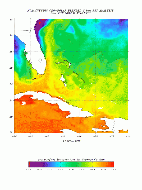
The various forecast guidance that I look at continues to show the very real possibility of a subtropical type storm to form near Florida’s East Coast by Thursday and Friday of next week bringing heavy rain and gusty winds to much of the Florida Peninsula late next week into possibly next weekend.
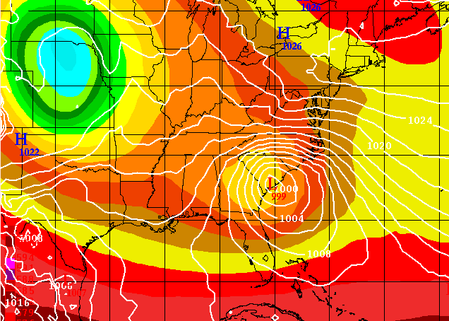
Looking at the particulars of each model: The European model forecasts that this system will develop near the eastern Gulf of Mexico very near Tampa on Thursday and then strengthen by Friday as it tracks eastward to a position just offshore of Cape Canaveral. The European model then forecasts this subtropical storm to track eastward across the northernmost Bahamas during next weekend.
The Canadian model guidance forecasts this subtropical system to develop near Great Abaco Island in the northernmost Bahamas on Thursday and then slowly track northeastward into the open Atlantic next weekend.
The NOGAPS model has this system developing near eastern North Carolina on Thursday and then slowly tracking north-northeastward along the Mid-Atlantic shoreline through next weekend. This scenario would lead to this system being non-tropical, but would still bring very heavy rainfall & gusty winds to much of the Mid-Atlantic states late next week into next weekend.
Here are my thoughts: The overall weather pattern from Wednesday of next week through next weekend will be one of strong high pressure building over New England which is actually a pattern that is favorable to look for some sort of tropical or subtropical development to the south of this high pressure system just off of the southeastern United States coast and this is what the guidance seems to be picking up on. With that said, it is not completely clear yet where exactly this storm system will form as there seems to be a range of possibilities from a development near Florida’s east coast to near eastern North Carolina. This large difference in possibilities will have a big impact on the possible effects from this storm as a development near Florida’s east coast would mean heavy rain and gusty winds for much of the Florida Peninsula and the northern Bahamas late next week into next weekend while development near eastern North Carolina would mean a heavy dousing of rain with gusty winds for much of the Mid-Atlantic states late next week into next weekend and Florida and the Bahamas would be spared.
At this point, I am leaning towards the idea of the development near Florida’s east coast as the overall pattern would support low pressure development here rather than further north up the coast. This is something that I will be keeping close tabs on over the next week and I will have additional posts as conditions warrant. For all our Crown Weather friends across the Florida Peninsula and the northern Bahamas, be aware that heavy rainfall with amounts of 2 to 3 inches and gusty east winds gusting to 40 mph are a possibility from Thursday through at least Saturday of next week.
www.crownweather.com/?p=7331
Here is the 00z Euro.


