Post by Briella - Houma on Dec 16, 2016 2:42:14 GMT -6
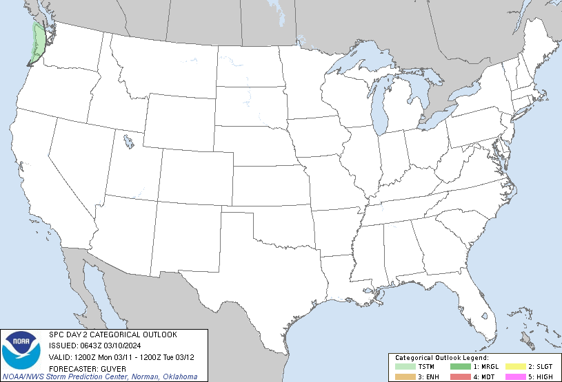
Day 2 Convective Outlook
NWS Storm Prediction Center Norman OK
0100 AM CST Fri Dec 16 2016
Valid 171200Z - 181200Z
...THERE IS A SLIGHT RISK OF SEVERE THUNDERSTORMS MS AND
NORTHWESTERN AL SOUTHWESTWARD TO THE LA GULF COAST VICINITY...
...THERE IS A MARGINAL RISK OF SEVERE THUNDERSTORMS SURROUNDING THE
SLIGHT RISK...AND INCLUDING PARTS OF TN AND EAST TX...
...SUMMARY...
Showers and thunderstorms are forecast across parts of the
south-central U.S. Saturday, with potential for scattered severe
storms within an area centered over the lower Mississippi Valley.
...Synopsis...
A large upper trough will shift across the central U.S. Day 2
(Saturday), with broad/surrounding cyclonic flow field to encompass
virtually the entire lower 48 states. At the surface, a low
initially in the vicinity of southern MO is expected to shift
northeastward across the OH Valley to the Great Lakes region through
the first half of the period, while a trailing cold front -- at the
leading edge of a surge of polar air -- advances
eastward/southeastward across the OH/TN/lower MS and Sabine River
Valleys through the day. By the end of the period, the front is
progged to crest the Appalachians, extending from the southeast PA
vicinity south-southwestward to mouth of the Mississippi River.
This front -- shifting into/through a gradually destabilizing lower
troposphere -- will focus development of showers and thunderstorms
from the mid-Ohio Valley and Mid-South region southwest to the
western Gulf coastal region.
...Parts of TN southwestward to the southeast TX/LA coasts...
Low-level theta-e advection is forecast to be ongoing across the
risk area at the start of the period, in advance of the approaching
cold front. Scattered showers and associated cloud cover -- driven
by low-level isentropic ascent atop a retreating polar airmass --
will limit destabilization potential in the pre-frontal warm sector.
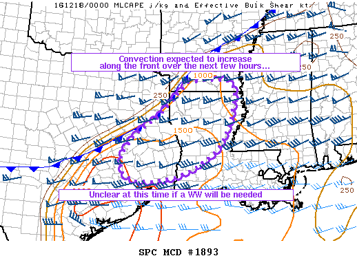
Still, models continue to suggest around 500 J/kg surface-based CAPE
will evolve at least as far north as southeast AR/northern
MS/northwest AL -- sufficient to support development of a frontal
band of showers and thunderstorms by mid to late afternoon.
At this time, it continues to appear that any pre-frontal storm
development will remain hindered to some degree given that
large-scale forcing associated with the positively-tilted upper
system will largely remain well to the north and west of the surface
frontal zone. While low-level and deep-layer shear will be
otherwise highly supportive of rotating updrafts (and associated
tornado risk), what appears at this time likely to be very limited
pre-frontal development should limit overall tornado risk. Instead,
the more likely evolution would appear to be a band of frontal
convection with local/embedded lewps and bows, with locally damaging
winds the primary severe risk. A few tornadoes would also be
possible near any embedded rotating updraft or comma head.
While the northeastern fringe of sufficient surface-based CAPE
development along the frontal zone remains difficult to determine,
it would appear that any severe risk farther northeastward than the
TN/KY border is too limited to warrant further expansion of the 5%
severe risk northeastward. Overnight, severe risk should persist as
convection moves east/southeast across LA/MS/western AL, before
diminishing eastward into eastern AL/GA as convection encounters
what should remain a more persistently stable environment.


