Post by SKYSUMMIT on Jul 13, 2019 11:43:25 GMT -6
i.ibb.co/WFzVYHj/2019-07-13-12-41-15-WPC-Met-Watch.png
Mesoscale Precipitation Discussion 0590
NWS Weather Prediction Center College Park MD
117 PM EDT Sat Jul 13 2019
Areas affected...far southeastern LA into southern MS/AL
Concerning...Heavy rainfall...Flash flooding possible
Valid 131716Z - 132315Z
Summary...Training rainfall, with rates of 1.5 to 2.5 in/hr, is
expected to develop across portions of the central Gulf Coast into
the afternoon. Flash flooding will be possible as soils become
less able to absorb additional rainfall over the next several
hours.
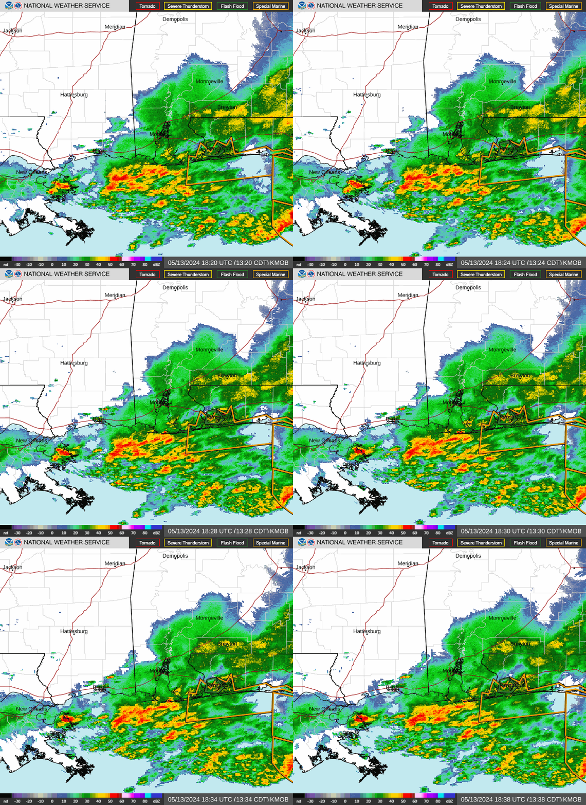
Discussion...Loops of KMOB reflectivity through 17Z showed a
nearly stationary axis of moderate to heavy rain extended about
200 miles east of the center of Hurricane Barry, from
south-central MS, across Mobile Bay to just east of the
Mississippi River Delta. The band of heavy rain was located just
on the cool side of a rain cooled boundary with rain rates ranging
on average from 0.5 to 1.0 in/hr. This axis of heavy rain has been
in place for hours across the region with many Wunderground.com
observations indicating that 3-5 inches of rain has fallen since
midnight in and around Mobile Bay. Rainfall of a more stratiform
nature existed farther north and west with rainfall totals closer
to 1 or 2 inches since midnight. SPC mesoanalyses indicate a
gradient in MLCAPE with less than 500 J/kg across southeastern LA
but between 1000 and 2000 J/kg over the western FL Panhandle into
southern MS.
Southerly to south-southwesterly 850 mb flow (via VWP and RAP
analyses) ranged from 30 kt along the FL/AL border to 50 kt along
the LA/MS border...near the Gulf Coast. Strong low level moisture
transport will continue to overrun the nearly stationary boundary
for at least another 2-3 hours. Given the steady rain that has
already fallen across southern MS into southern AL, soils are
beginning to saturate. A small shift in orientation to the
existing boundary to a more south/north placement could better
align with the low level flow allowing for a more efficient axis
of training to develop. Beyond 20Z or so, there are indications
that as Barry continues off to the west, reformation of a low
level confluence axis and subsequent rain band formation may occur
farther west into southern MS or the MS River Delta region of LA.
6 hour rainfall totals could peak in the 3-5 inch range through
23Z. As soils begin to take on more water from ongoing stratiform
rain, combined with any training heavy rain, flash flooding will
become possible.
Otto
i.ibb.co/F5w9vm1/2019-07-13-12-42-25-KMOB-Mobile-AL-GRLevel3.png


