Severe Weather Discussion - 3/17/2021 (St Patty's Day)
Mar 17, 2021 9:26:24 GMT -6
harpman - old, Stephanie Carpenter, WBANK JP, and 2 more like this
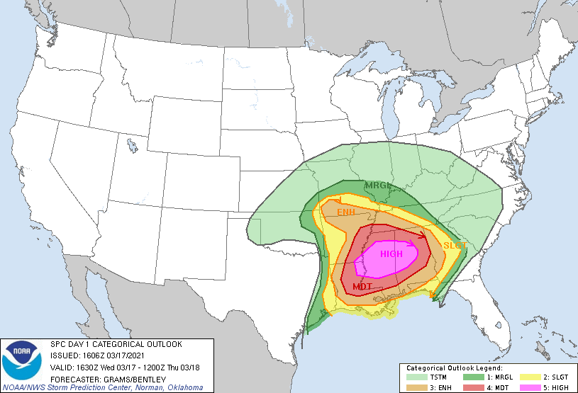
High Risk
|
|||
|
|||
|
|||
|
|||
|
|||
|
|||
|
|||
|
|||
|
|||
|
|||
|
|||
|
|||
|
|||
|
|||
|