Is hail typically associated with hurricanes or not?
ooooh....mostly in only VERY intense hurricanes.
Buying or Selling Real Estate?--->scottguidry.com United Real Estate Partners - New Orleans / North Shore Scott Guidry, Realtor, ABR, AHWD, AWREP, C2EX Click HERE To Download My FREE MLS Touch App! NWS COOP ID: 16-7425-08 CoCoRaHs ID: LA-TG-23
My daughter just called me and her work, Whitney bank is not closing at all. WTH is wrong with them? Having employees out in 90 plus winds. Ridiculous!
I work for Whitney and this is a little misleading. Yes, we're at work today and suspect we'll be in in the morning. However, I'd be surprised if we work passed early afternoon. I can also promise you that unless things drastically change your daughter will not have to report on Wednesday.
My daughter just called me and her work, Whitney bank is not closing at all. WTH is wrong with them? Having employees out in 90 plus winds. Ridiculous!
Hubby just said the same thing about his job. I have no idea what these people are thinking.
My daughter just called me and her work, Whitney bank is not closing at all. WTH is wrong with them? Having employees out in 90 plus winds. Ridiculous!
As of right now, my DH has to go from the River Parishes to downtown New Orleans for work tomorrow. He then has to drive his truck back to the River Parishes, run his route, get back downtown, and then drive back home. I am strongly hoping they will change their mind. Especially since that big delivery truck is tall and the wind will push it around.
My daughter just called me and her work, Whitney bank is not closing at all. WTH is wrong with them? Having employees out in 90 plus winds. Ridiculous!
Hubby just said the same thing about his job. I have no idea what these people are thinking.
Probably because they see that it has not been upgraded to a hurricane yet, they might change their mind come tomorrow morning.
mrjamie
GCWX Supporter Vice President | Chief Consultant
Does anyone know what the storm surge for the lake is forecast to be? I live on the lake right by the rigolets bridge and am trying to decide when to leave. Thanks so much for all your information.
My daughter just called me and her work, Whitney bank is not closing at all. WTH is wrong with them? Having employees out in 90 plus winds. Ridiculous!
I work for Whitney and this is a little misleading. Yes, we're at work today and suspect we'll be in in the morning. However, I'd be surprised if we work passed early afternoon. I can also promise you that unless things drastically change your daughter will not have to report on Wednesday.
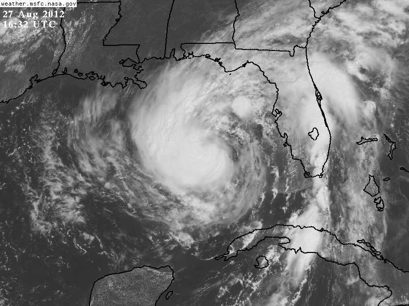
Post by Zack Fradella on Aug 27, 2012 11:16:34 GMT -6
FLOOD WATCH NATIONAL WEATHER SERVICE NEW ORLEANS LA 1120 AM CDT MON AUG 27 2012
...FLASH FLOOD WATCH IN EFFECT FROM 7 AM TUESDAY MORNING THROUGH 7 PM CDT WEDNESDAY...
.WIDESPREAD HEAVY RAIN EXPECTED BEGINNING TUESDAY MORNING AND LASTING THROUGH LATE WEDNESDAY AFTERNOON AS SLOW MOVING TROPICAL SYSTEM ISAAC MOVES ACROSS THE REGION.. MANY AREAS ARE LIKELY TO RECEIVE 10 TO 15 INCHES OF RAINFALL OVER A 36 HOUR PERIOD WITH LOCALLY UP TO 20 INCHES POSSIBLE.
LAZ034>037-039-040-046>050-056>072-MSZ068>071-077-080>082-280030- /O.NEW.KLIX.FF.A.0010.120828T1200Z-120830T0000Z/ /00000.0.ER.000000T0000Z.000000T0000Z.000000T0000Z.OO/ POINTE COUPEE-WEST FELICIANA-EAST FELICIANA-ST. HELENA-WASHINGTON- ST. TAMMANY-IBERVILLE-WEST BATON ROUGE-EAST BATON ROUGE-ASCENSION- LIVINGSTON-ASSUMPTION-ST. JAMES-ST. JOHN THE BAPTIST- UPPER LAFOURCHE-ST. CHARLES-UPPER JEFFERSON-ORLEANS- UPPER PLAQUEMINES-UPPER ST. BERNARD-UPPER TERREBONNE- LOWER TERREBONNE-LOWER LAFOURCHE-LOWER JEFFERSON- LOWER PLAQUEMINES-LOWER ST. BERNARD-NORTHERN TANGIPAHOA- SOUTHERN TANGIPAHOA-WILKINSON-AMITE-PIKE-WALTHALL-PEARL RIVER- HANCOCK-HARRISON-JACKSON- INCLUDING THE CITIES OF...NEW ROADS...LIVONIA... ST. FRANCISVILLE...JACKSON...CLINTON...GREENSBURG...MONTPELIER... BOGALUSA...FRANKLINTON...SLIDELL...MANDEVILLE...COVINGTON... LACOMBE...PLAQUEMINE...WHITE CASTLE...PORT ALLEN...ADDIS... BRUSLY...BATON ROUGE...GONZALES...DONALDSONVILLE... DENHAM SPRINGS...WALKER...PIERRE PART...LABADIEVILLE... PAINCOURTVILLE...LUTCHER...GRAMERCY...LAPLACE...RESERVE... THIBODAUX...RACELAND...LAROSE...DESTREHAN...NORCO...METAIRIE... KENNER...NEW ORLEANS...BELLE CHASSE...CHALMETTE...VIOLET... HOUMA...BAYOU CANE...CHAUVIN...DULAC...MONTEGUT...GALLIANO... CUT OFF...GOLDEN MEADOW...PORT SULPHUR...EMPIRE...YSCLOSKEY... AMITE...KENTWOOD...HAMMOND...PONCHATOULA...CENTREVILLE... WOODVILLE...GLOSTER...LIBERTY...CROSBY...MCCOMB...TYLERTOWN... PICAYUNE...BAY ST. LOUIS...WAVELAND...DIAMONDHEAD...GULFPORT... BILOXI...PASCAGOULA...OCEAN SPRINGS...MOSS POINT...GAUTIER... ST. MARTIN 1120 AM CDT MON AUG 27 2012
...FLASH FLOOD WATCH IN EFFECT FROM 7 AM TUESDAY MORNING THROUGH 7 PM WEDNESDAY EVENING...
THE NATIONAL WEATHER SERVICE IN NEW ORLEANS HAS ISSUED A
* FLASH FLOOD WATCH FOR PORTIONS OF SOUTHEAST LOUISIANA AND SOUTHERN MISSISSIPPI...INCLUDING THE FOLLOWING AREAS...IN SOUTHEAST LOUISIANA...ASCENSION...ASSUMPTION...EAST BATON ROUGE...EAST FELICIANA...IBERVILLE...LIVINGSTON...LOWER JEFFERSON...LOWER LAFOURCHE...LOWER PLAQUEMINES...LOWER ST. BERNARD...LOWER TERREBONNE...NORTHERN TANGIPAHOA...ORLEANS... POINTE COUPEE...SOUTHERN TANGIPAHOA...ST. CHARLES...ST. HELENA...ST. JAMES...ST. JOHN THE BAPTIST...ST. TAMMANY... UPPER JEFFERSON...UPPER LAFOURCHE...UPPER PLAQUEMINES...UPPER ST. BERNARD...UPPER TERREBONNE...WASHINGTON...WEST BATON ROUGE AND WEST FELICIANA. IN SOUTHERN MISSISSIPPI...AMITE... HANCOCK...HARRISON...JACKSON...PEARL RIVER...PIKE...WALTHALL AND WILKINSON.
* FROM TUESDAY MORNING AT 7 AM THROUGH 7 PM WEDNESDAY EVENING
* HEAVY RAINFALL POSSIBLE AS TROPICAL SYSTEM ISAAC MOVES SLOWLY NORTHWESTWARD ON TUESDAY THROUGH WEDNESDAY AFTERNOON. RAINFALL TOTALS ARE EXPECTED TO RANGE BETWEEN 10 AND 15 INCHES OVER A 36 HOUR PERIOD WITH LOCALLY UP TO 20 INCHES POSSIBLE.
* RAINFALL RATES MAY OVERWHELM DRAINAGE SYSTEMS AND PUMPS...RESULTING IN RAPID RUNOFF AND STREET FLOODING. LOW LYING AND FLOOD PRONE AREAS MAY EXPERIENCE FLASH FLOODING CAPABLE OF STALLING CARS AND THREATENING HOMES AND BUSINESSES.
PRECAUTIONARY/PREPAREDNESS ACTIONS...
A FLASH FLOOD WATCH MEANS THAT CONDITIONS MAY DEVELOP THAT LEAD TO FLASH FLOODING. FLASH FLOODING IS A VERY DANGEROUS SITUATION.
YOU SHOULD MONITOR LATER FORECASTS AND BE PREPARED TO TAKE ACTION SHOULD FLASH FLOOD WARNINGS BE ISSUED.
&&
Last Edit: Aug 27, 2012 11:17:04 GMT -6 by Zack Fradella
My daughter just called me and her work, Whitney bank is not closing at all. WTH is wrong with them? Having employees out in 90 plus winds. Ridiculous!
Hubby just said the same thing about his job. I have no idea what these people are thinking.
. Maybe because local media are downplaying it a little, they don't realize how bad this MIGHT be.
I Live in Eden Isles in Slidell and still trying to decide what to do. I work at the airport in Kenner for TSA and as of yet we have not been released, so until we are released I can't go anywhere.
Post by gullywasher on Aug 27, 2012 11:17:28 GMT -6
Time to break out the old "answer by the numbers " post
If I owned Baskins & Robbins, I would feature a special at all stores in a storms path. It would be a double scoop for the price of a single, but it would be two different flavors of the largest in inventory. Since this would be the servers decision........why of course, it would be called ........................"The Cone of Uncertainity"
Shoutbox
northshoreelise: not on the 12z...
Oct 10, 2024 12:15:21 GMT -6
lencast: Really would appreciate it. Thank you, Lena
Sept 27, 2024 5:20:46 GMT -6
lencast: I am in Jacksonville, and trying to drive back to New Orleans. Does anyone here know if the I-10 is passable in Lake City and Tallahassee.
Sept 27, 2024 5:19:03 GMT -6
tcane: This sure looks like it dies quickly. maybe falling apart before metro New Orleans? Just looking at the lat dozen posts and images here.
Sept 10, 2024 11:26:27 GMT -6
rebekahb-Metairie: Looks like it but I wait for the better trained eyes on the forum to respond.
Sept 9, 2024 18:52:32 GMT -6
SKYSUMMIT: Oh sorry guys! I didn't eve see these new messages down here lol
Jul 26, 2024 13:14:47 GMT -6
jenniqtip: Just as soon as* sry fat finger
Jul 7, 2024 12:53:35 GMT -6
jenniqtip: I donate every year. 😀ju sry as soon as the first area of interest pops up!! I rarely post though so the tag isn’t necessary. Just know I appreciate everything you do!!
Jul 7, 2024 12:53:12 GMT -6
larcat: SKYSUMMIT You can slap one on me
Jul 7, 2024 12:12:03 GMT -6
SKYSUMMIT: Thanks laismyhome ! Also, if there is anyone who has donated that has not been given the Supporter tag, please let us know.
Jul 7, 2024 4:00:50 GMT -6
laismyhome: Here's a friendly reminder to go make a donation to support this forum that is so full of valuable reliable info. Link to donate is on homepage
Jul 2, 2024 9:55:24 GMT -6
Deleted: Ernesto gonna mog hard. I'm voting Alberto, Ernesto, Rafael and Deshawn
Apr 1, 2024 19:15:21 GMT -6
SKYSUMMIT: ShanaBanana Yes...just click the link and then send a PM to either TIgergirl or myself. I can then shoot her a text letting her know and I'll add your supporter tag. THANK YOU!!!!
Sept 23, 2023 16:08:37 GMT -6
ShanaBanana: At the risk of this being a dumb question. In order to donate, do I follow the instructions when I click “donate”, and then message tigergirl? I see people comment here that they donated, so I wasn’t sure if that had changed.
Sept 20, 2023 10:54:40 GMT -6
SKYSUMMIT: Great to have you back!
Sept 11, 2023 12:20:30 GMT -6
virginialee: Hi Skysummit: I was part of this back at the beginning. So happy to be back.
Sept 8, 2023 5:08:12 GMT -6
SKYSUMMIT: Thanks to everyone who has recently donated! If I missed anyone and you still need a Supporter Tag, let me know.
Sept 7, 2023 13:20:10 GMT -6
akeller11: Just donated
Sept 6, 2023 11:11:36 GMT -6
SKYSUMMIT: Thanks guys and gals! You're very much appreciated!
Aug 30, 2023 11:48:38 GMT -6