FWIW, some of the mesoscale models (namely the HRRR and one of the WRF variants) spin this into a tropical cyclone before moving ashore over the Big Bend in the next two days. This isn't unbelievable considering the vigorous 850mb circulation the Euro and GFS develop (although neither of them develops an actual tropical cyclone). It's good to be wary of using mesoscale models for any sort of tropical development, but their increased resolution can pickup on small circulations that global models can miss.
At the moment, the main threat of tropical development looks to come from another area of vorticity that dips out into the Gulf in the 5-7 day range. This is the area that the Euro has been developing on and off; a cluster of GFS and Euro ensemble members show this lobe developing and tracking west a la Edouard '08.
SKYSUMMIT
Administrator President | Director of Operations
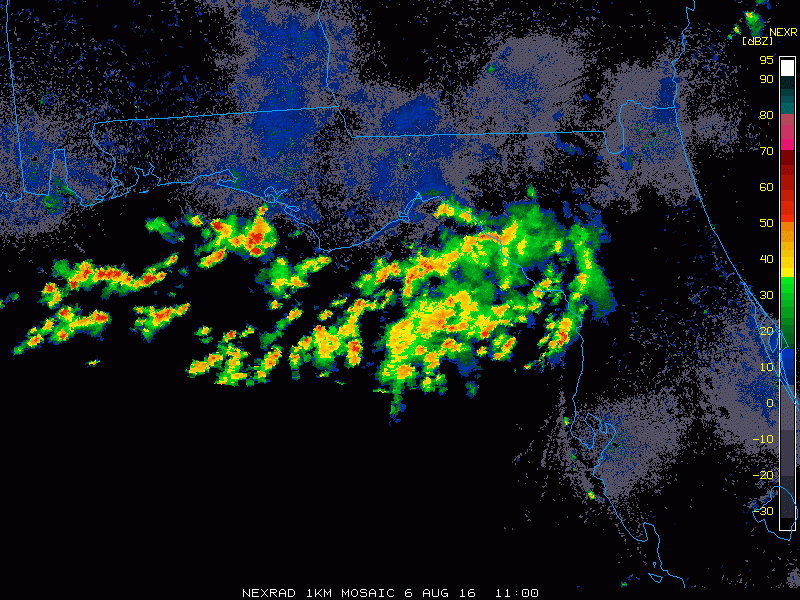
Meanwhile, the existing 850mb vorticity has gotten just a tad tighter over the past couple hours. GRE screenshot:
Buying or Selling Real Estate?--->scottguidry.com United Real Estate Partners - New Orleans / North Shore Scott Guidry, Realtor, ABR, AHWD, AWREP, C2EX Click HERE To Download My FREE MLS Touch App! NWS COOP ID: 16-7425-08 CoCoRaHs ID: LA-TG-23
Confidence is high in a prolonged period of wet weather across the region as an upper low meanders along the Gulf Coast through the short term period and beyond. Operational guidance remains consistent tonight in forecasting PWAT values of 2 to 2.5 inches across the region by Sunday and Monday, which would challenge daily records at the TAE sounding site. This, coupled with lobes of energy rotating around the low will yield widespread shower and thunderstorm activity. Given the tropical airmass in place, all storms will be very efficient rainfall producers introducing the threat for flooding across the area. The latest model guidance continues to point at southeastern portions of the Big Bend region as the area favored to see the highest rainfall accumulations, with the heaviest rainfall currently on track to begin Sunday night/Monday morning timeframe. The possibility of a flood watch continues to increase tonight as a result and will be discussed with subsequent shifts today.
As far as temperatures go, decided to undercut guidance by a few degrees across the region. Forecast highs ran a few degrees above reality yesterday due to increased cloud coverage and an early start to showers. As a result, highs generally running in the mid to upper 80s near the coast and lower 90s further inland can be expected.
.LONG TERM [Monday Night Through Saturday]...
The forecast challenge will continue to be heavy rainfall into the long term period, as the aforementioned low slowly meanders westward through the week. Due to the slow movement of this system, high rain chances will remain in the forecast through the week, with extraordinary rainfall amounts forecast, especially in the Big Bend region of the Florida Panhandle. Though tropical in nature, this system continues to only garner a 20% chance of becoming a tropical entity in the next 48 hours. Regardless of whether this system progresses in this way or not, the main threat from this system will be heavy rainfall and flooding across the region. The latest WPC guidance generally continues to indicate 5 to 10" of rain across coastal portions of the Florida Panhandle with 3 to 5" inland over the course of the next week, whereas the operational GFS and ECMWF QPF solutions continue to contrast each other significantly. It will be interesting to see which solution trends toward the other as time passes, but for now will err between the two regarding storm total QPF amounts. Overall, high temperatures will remain below average through the week, generally in the mid to upper 80s, as abundant cloud cover and rainfall will diurnal trends.
Buying or Selling Real Estate?--->scottguidry.com United Real Estate Partners - New Orleans / North Shore Scott Guidry, Realtor, ABR, AHWD, AWREP, C2EX Click HERE To Download My FREE MLS Touch App! NWS COOP ID: 16-7425-08 CoCoRaHs ID: LA-TG-23
SKYSUMMIT
Administrator President | Director of Operations
TROPICAL WEATHER OUTLOOK NWS NATIONAL HURRICANE CENTER MIAMI FL 200 PM EDT SAT AUG 6 2016
For the North Atlantic...Caribbean Sea and the Gulf of Mexico:
The National Hurricane Center has issued the last advisory on Earl, which dissipated well inland near Mexico City.
An area of cloudiness and thunderstorms associated with a trough of low pressure is located over the northeastern Gulf of Mexico. Some slight development is possible before the system moves inland over the southeastern United States in a couple of days. Regardless of development, heavy rainfall over northern Florida is anticipated. * Formation chance through 48 hours...low...20 percent * Formation chance through 5 days...low...20 percent
A tropical wave is producing disorganized cloudiness and showers just north of Puerto Rico and the adjacent Atlantic. This activity is expected to move northwestward and northward, and an area of low pressure could form in the Atlantic by the middle of next week between Florida and Bermuda. * Formation chance through 48 hours...low...near 0 percent * Formation chance through 5 days...low...20 percent
Buying or Selling Real Estate?--->scottguidry.com United Real Estate Partners - New Orleans / North Shore Scott Guidry, Realtor, ABR, AHWD, AWREP, C2EX Click HERE To Download My FREE MLS Touch App! NWS COOP ID: 16-7425-08 CoCoRaHs ID: LA-TG-23
SKYSUMMIT
Administrator President | Director of Operations
The strongest 850mb vorticity is currently over land:
Buying or Selling Real Estate?--->scottguidry.com United Real Estate Partners - New Orleans / North Shore Scott Guidry, Realtor, ABR, AHWD, AWREP, C2EX Click HERE To Download My FREE MLS Touch App! NWS COOP ID: 16-7425-08 CoCoRaHs ID: LA-TG-23
Shoutbox
northshoreelise: not on the 12z...
Oct 10, 2024 12:15:21 GMT -6
lencast: Really would appreciate it. Thank you, Lena
Sept 27, 2024 5:20:46 GMT -6
lencast: I am in Jacksonville, and trying to drive back to New Orleans. Does anyone here know if the I-10 is passable in Lake City and Tallahassee.
Sept 27, 2024 5:19:03 GMT -6
tcane: This sure looks like it dies quickly. maybe falling apart before metro New Orleans? Just looking at the lat dozen posts and images here.
Sept 10, 2024 11:26:27 GMT -6
rebekahb-Metairie: Looks like it but I wait for the better trained eyes on the forum to respond.
Sept 9, 2024 18:52:32 GMT -6
SKYSUMMIT: Oh sorry guys! I didn't eve see these new messages down here lol
Jul 26, 2024 13:14:47 GMT -6
jenniqtip: Just as soon as* sry fat finger
Jul 7, 2024 12:53:35 GMT -6
jenniqtip: I donate every year. 😀ju sry as soon as the first area of interest pops up!! I rarely post though so the tag isn’t necessary. Just know I appreciate everything you do!!
Jul 7, 2024 12:53:12 GMT -6
larcat: SKYSUMMIT You can slap one on me
Jul 7, 2024 12:12:03 GMT -6
SKYSUMMIT: Thanks laismyhome ! Also, if there is anyone who has donated that has not been given the Supporter tag, please let us know.
Jul 7, 2024 4:00:50 GMT -6
laismyhome: Here's a friendly reminder to go make a donation to support this forum that is so full of valuable reliable info. Link to donate is on homepage
Jul 2, 2024 9:55:24 GMT -6
Deleted: Ernesto gonna mog hard. I'm voting Alberto, Ernesto, Rafael and Deshawn
Apr 1, 2024 19:15:21 GMT -6
SKYSUMMIT: ShanaBanana Yes...just click the link and then send a PM to either TIgergirl or myself. I can then shoot her a text letting her know and I'll add your supporter tag. THANK YOU!!!!
Sept 23, 2023 16:08:37 GMT -6
ShanaBanana: At the risk of this being a dumb question. In order to donate, do I follow the instructions when I click “donate”, and then message tigergirl? I see people comment here that they donated, so I wasn’t sure if that had changed.
Sept 20, 2023 10:54:40 GMT -6
SKYSUMMIT: Great to have you back!
Sept 11, 2023 12:20:30 GMT -6
virginialee: Hi Skysummit: I was part of this back at the beginning. So happy to be back.
Sept 8, 2023 5:08:12 GMT -6
SKYSUMMIT: Thanks to everyone who has recently donated! If I missed anyone and you still need a Supporter Tag, let me know.
Sept 7, 2023 13:20:10 GMT -6
akeller11: Just donated
Sept 6, 2023 11:11:36 GMT -6
SKYSUMMIT: Thanks guys and gals! You're very much appreciated!
Aug 30, 2023 11:48:38 GMT -6