Easter Severe Weather! "Dixie Alley" under Moderate Risk
Apr 8, 2020 8:54:17 GMT -6
harpman - old and NavyMom: WBR Parish like this
Post by thermalwind - Touro on Apr 8, 2020 8:54:17 GMT -6
After a beautiful March that provided great, if a little warm weather for all the cancelled festivals, severe weather season returns this weekend.
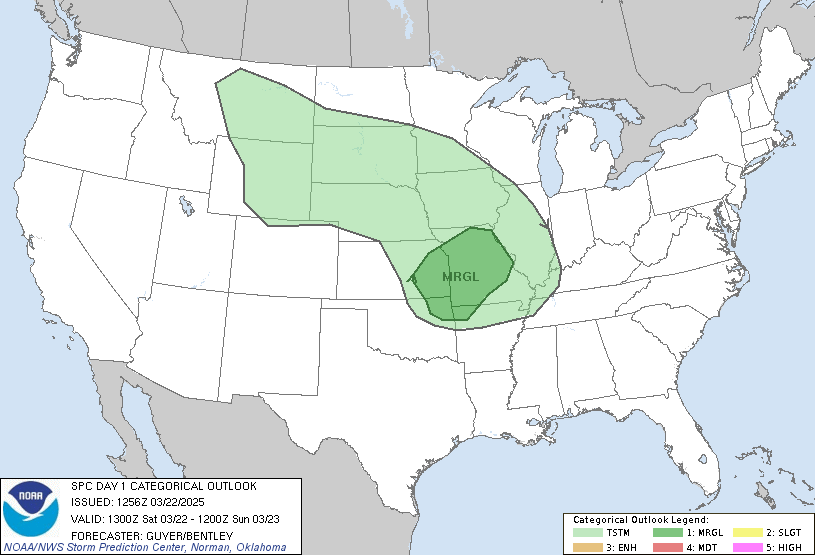
Day 1 trimmed to slight for most of southeast Louisiana. Moderate extended toward GA. Look out for tornadoes in NC tomorrow morning too.
For the Friday morning update, I'm going to take the incredible AFD that LIX put out this morning (shout out to /CAB/ @ulmwxr on twitter for writing it up in such detail) and go through it with model outputs to illustrate what he's saying. The focus will be for the SELa and northern gulf coast here. I'll probably discuss why north of us has the greater risk in the thread.


The SoCal swirl is the main piece of energy for this system. It's going to come across and meet up with some energy from the north and phase together. The resultant trough will have a negative tilt to it as it comes into the Mississippi valley on Sunday before pulling north toward the great lakes.

Note the ridging over toward Florida and along the east coast in your head.
At the surface:

There it is. Low forms up off the front range of the Rockies for complicated reasons that *very basically* boil down to column of air stretches as it falls off the side of the high mountains which increases the vorticity through the stretching. This is an interesting topic for another day. Point is, there's our surface low forming up late Saturday evening and it's going to be in a hurry to get east.

There's a high off the east coast. You can see the clockwise wind barbs around it. So good pressure gradient between our high and low and positioning is going to drive big time southern flow off the gulf.
To sum up what we've seen so far:
Shortwave comes, it enhances lift over the area for reasons (QG omega eqn comes to mind, look that up at your own peril) and we have lower pressures at the surface during the best period for severe weather (daytime heating) and those heights mean colder air aloft which aids the instability.

Off the UKMet, this is the wind field at 850 mb. Got some 65-70 kt readings. Point is, strong low level winds.


NAM sounding to give some idea of the storm relative helicity (SRH) that's being talked about here. I like pivotal weather's soundings better but it's acting up this morning. It's a free site, so can't really complain much.
You can see that on the NAM sounding I posted above. Abundant CAPE, an inversion around 850 mb, and the steeper slope of the temperature line showing how the temperature drops with height. That's a strong thermo profile for springtime dynamics in these parts.
Now the anticipated timeline of events:
So around noon we could see severe storms get popping.
Be aware, while the highest risk of impact would be any supercells that could form up, this QLCS will impact far more people.
So finally, what could disrupt this system's impacts for us?
So CAP doesn't set up, too many storms early and sucks out some instability/doesn't let it build. Wouldn't mind seeing that at all.
Hints of some veer-back-veer up above us. Subtle but could be enough to disrupt potential supercells from reaching maturity.
In summary, all the ingredients are in place and timed right for a significant severe weather event all through the deep south and in our neck of the woods. So be weather aware Sunday, be able to get warnings, and keep an eye on the radar. I'm going to keep this post up most likely as it explains the set up pretty well from the big picture. Will edit it for changes in risk ranges and if anything is showing up that could materially change the risk profile.
Read your local forecast discussions. LIX ADF MOB AFD JAN AFD SHV AFD BMX AFD
Check the SPC for mesoscale discussions and convective outlooks. SPC
Fin.

Day 1 trimmed to slight for most of southeast Louisiana. Moderate extended toward GA. Look out for tornadoes in NC tomorrow morning too.
For the Friday morning update, I'm going to take the incredible AFD that LIX put out this morning (shout out to /CAB/ @ulmwxr on twitter for writing it up in such detail) and go through it with model outputs to illustrate what he's saying. The focus will be for the SELa and northern gulf coast here. I'll probably discuss why north of us has the greater risk in the thread.
Everything points to the potential of a large
severe weather outbreak across the Gulf South. The main
protagonist is still spinning along the southern CA coast.
Through today and tonight it will slowly work east-southeast
inland along the US/MX border.
severe weather outbreak across the Gulf South. The main
protagonist is still spinning along the southern CA coast.
Through today and tonight it will slowly work east-southeast
inland along the US/MX border.

The SoCal swirl is the main piece of energy for this system. It's going to come across and meet up with some energy from the north and phase together. The resultant trough will have a negative tilt to it as it comes into the Mississippi valley on Sunday before pulling north toward the great lakes.

Note the ridging over toward Florida and along the east coast in your head.
At the surface:
At the sfc we will see
cyclogenesis on the Lee of the Rockies and this sfc low will
slowly deepen as it moves towards the Lower and Mid MS Valley`s
and then the Great Lakes Monday morning. The sfc low will likely
be deepening to near 990 mb as it moves through the Lower MS
Valley and just before it begins to lift to the northeast.

There it is. Low forms up off the front range of the Rockies for complicated reasons that *very basically* boil down to column of air stretches as it falls off the side of the high mountains which increases the vorticity through the stretching. This is an interesting topic for another day. Point is, there's our surface low forming up late Saturday evening and it's going to be in a hurry to get east.

There's a high off the east coast. You can see the clockwise wind barbs around it. So good pressure gradient between our high and low and positioning is going to drive big time southern flow off the gulf.
Combine
that with a very stout sfc high in the western Atlantic and the
pressure gradient will be rather tight across the area and much of
the Gulf for that matter. This will allow for deep rich gulf
moisture to quickly be transported back to the north ahead of our
severe weather.
that with a very stout sfc high in the western Atlantic and the
pressure gradient will be rather tight across the area and much of
the Gulf for that matter. This will allow for deep rich gulf
moisture to quickly be transported back to the north ahead of our
severe weather.
To sum up what we've seen so far:
So looking at the potential for severe weather. Synoptically this
is a very favorable setup. The track of the s/w across the Lower
MS Valley and lifting to the northeast over the TN Valley is
ideal with h5 hghts around 572-578dm. The track and strength of
the sfc low is also favorable with MSLP expected to be sub 1004mb
across much of the area from around 15z-00z.
Shortwave comes, it enhances lift over the area for reasons (QG omega eqn comes to mind, look that up at your own peril) and we have lower pressures at the surface during the best period for severe weather (daytime heating) and those heights mean colder air aloft which aids the instability.

Off the UKMet, this is the wind field at 850 mb. Got some 65-70 kt readings. Point is, strong low level winds.
First looking at the wind field, as the
system approaches the Lower MS Valley the LL winds will respond
and a LL jet of 50-65kts and intensifying will develop and move
across the CWA. At h5 a mid level jet of 70-90kts will punch into
the area from the west.
system approaches the Lower MS Valley the LL winds will respond
and a LL jet of 50-65kts and intensifying will develop and move
across the CWA. At h5 a mid level jet of 70-90kts will punch into
the area from the west.

The upper jet is interesting as initially
it looks to try and split with a piece trying to remain in the
southern branch riding over the ridge centered in the western
Caribbean while the rest tries to go north. This initially puts
the area under a rather nice area of divergence.
it looks to try and split with a piece trying to remain in the
southern branch riding over the ridge centered in the western
Caribbean while the rest tries to go north. This initially puts
the area under a rather nice area of divergence.

The increase in
the wind field is leading to a rather sheared environment and to
make things worse the deepening sfc low looks like it could lead
to winds at the sfc backing initially in the day. This would
greatly increase the SRH with most of the models both global and
CAMS indicating 0-1km SRH over 300 m2/s2 and 0-3km SRH over 500
m2/s2. 0-6km bulk shear is also expected to be quite strong around
60-70kts.

NAM sounding to give some idea of the storm relative helicity (SRH) that's being talked about here. I like pivotal weather's soundings better but it's acting up this morning. It's a free site, so can't really complain much.
As for instability this doesn`t appear to be an issue
either for this event. Overnight showers and maybe a few embedded
thunderstorms will quickly lift to the north and moisture will
continue to increase through the morning. There is expected to be
a cap in place around h85 and it is expected to hold till right
around 17/18z. This will allow the area to heat up becoming quite
unstable MLCAPE around 2-2500 J/kg possibly greater. Mid level
lapse rates will be quite steep possibly around 6.3-6.8 C/km
(maybe steeper). LI`s could even approach -8 to -9
Now the anticipated timeline of events:
Given everything right now the forecast looks like we will see rain
clear out of the area early Sunday morning. This will then lead to
our area heating up through the morning under what will likely be
partly cloudy skies. Moisture will continue to increase and sometime
between 15 and 18z we may start to see popcorn like showers with the
cap finally beginning to erode/break around 18z. If this
environment is in place, once these storms begin to break the cap
they may rapidly intensify and could quickly become supercellular.
So around noon we could see severe storms get popping.
These initial storms will be of the greatest concern as they will
be able to tap into the environment without being disturbed by
other storms/activity and will have the best chance of producing
tornadoes, possibly even long tracked strong tornadoes. These
storms could begin to develop right across south-central LA and
will likely race to the northeast.
be able to tap into the environment without being disturbed by
other storms/activity and will have the best chance of producing
tornadoes, possibly even long tracked strong tornadoes. These
storms could begin to develop right across south-central LA and
will likely race to the northeast.
Later in the afternoon as the
forcing in the mid and upper level intensifies and the shear
begins to become a little more unidirectional we expect to see
storms congeal into what could be a rather intense QLCS. This will
then transition into more of a damaging wind threat however with
these types of lines quick spin up tornadoes embedded in the line
are likely. This will likely occur just to our west or over our
western parishes and counties between 21-00z and quickly race east
with much of the activity expected to be out of our CWA before
6z.
Be aware, while the highest risk of impact would be any supercells that could form up, this QLCS will impact far more people.
So finally, what could disrupt this system's impacts for us?
Ok now this isn`t a slam dunk forecast, it never is obviously. So
what are some failure modes. First would be if the track of both the
sfc low and s/w is farther to the north and we lose that intense
forcing. Another thing to watch for would be the cap. If the cap
breaks too quickly or doesn`t even develop then we will not realize
the instability that is currently being forecast. With that the
explosiveness of storm development would not occur, however we would
probably see some severe weather still just not at the intensity we
could. There is also some indication in the forecast soundings that
winds from h7-h5 could back a little and this can have an impact on
mode. It just takes one or two things to not go as forecast and the
entire event is changed but given what we have in place, this looks
like it could be a rather significant event.
So CAP doesn't set up, too many storms early and sucks out some instability/doesn't let it build. Wouldn't mind seeing that at all.
Hints of some veer-back-veer up above us. Subtle but could be enough to disrupt potential supercells from reaching maturity.
In summary, all the ingredients are in place and timed right for a significant severe weather event all through the deep south and in our neck of the woods. So be weather aware Sunday, be able to get warnings, and keep an eye on the radar. I'm going to keep this post up most likely as it explains the set up pretty well from the big picture. Will edit it for changes in risk ranges and if anything is showing up that could materially change the risk profile.
Read your local forecast discussions. LIX ADF MOB AFD JAN AFD SHV AFD BMX AFD
Check the SPC for mesoscale discussions and convective outlooks. SPC
Fin.


